
 |
| Mulholland Light to the left, Lubec to the right |
Friar Bay was recommended by the information center as the place where they paddled, and conveniently it was quite close. It's a broad open bay, with a nice rock/sandy bottom. Friar Head and a sea stack are located to the southwest side of the bay. Friar Bay is where Franklin Roosevelt used to anchor his yacht when he came to visit his summer residence on Campobello Island.
We paddled off to the sea stacks, going by several sights on the way. A couple abandoned boats, one old, one newer.


Some sort of aquaculture marked by yellow buoys.

The sea stack looks most like a friar in this photo.


Lots of sea stars, and urchins. (They were mostly on rockier shores)

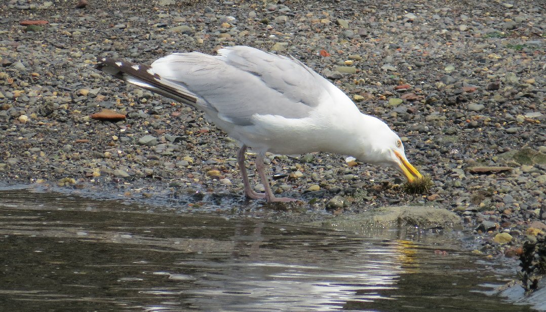
This sea gull gets to enjoy an urchin.
Sand dollars freckled across the floor.

We paddled down to Mulholland Lighthouse. The narrows under FDR bridge are marked as hazardous for navigations because of the fast currents there mid tide.
Out along Friar Bay, though, the water was peaceful and quiet, with plenty of time to observe the ocean floor. We arrived back nearly at dead low, with quite a bit more sandy bottom to cross to return to our cars.


Summary: Launch Friar Bay Beach, adequate parking, no facilities. There is an information center about a mile away. We launched at 10:30 EDT, finished at noon. Low was at 12:40. About 3.5 miles. We headed back to Lubec for lunch, where we captured one of my favorite shots of the day, looking back toward Mulholland Light.

Nice series
ReplyDeleteThanks John, try to stay cool today!
DeleteIt is Friar's Bay....Friar's Head is the "sea stack".
ReplyDeleteA 'head' often refers to a high prominent point or bluff, I think the rocky outcropping is the head, and I thought both the bay and the head may have gotten their name's from the sea stack which looks friar-like. I was not able to confirm that through any searches though, or find any other explanation behind the name.
DeleteTrina is correct. The bay is named for the "sea stack" that resembles a Friar. And you are correct that it is located on rocky outcropping or "head". The Friar was formed by cannon fire when it was used during target practice by military forces.
ReplyDelete