Thursday, July 28, 2011

Porcupine Islands Again

Basics: Launch Bar at the end of Bridge Street in Bar Harbor. No parking: parking is available on West Street and side streets. No facilities: the information booth on Thompson Island has toilets, as does the town dock.  High 8.22AM Launch 9:00AM Finish 1:30 PM, 12 miles.

The Porcupines again?  Why not, not only are the Porcupines only an hour away, but I think the Porcupine Islands are one of the best sea kayak trips Maine has to offer.  They have dramatic cliffs, water which feels like open ocean instead of a pond, salt air smell and most important, a backdrop of mountains, lobster boats and sailboats.  And, as is probably no coincidence, Bar Harbor offers many guided kayak tours out to the Porcupines.  Most of the group trips won’t make it out as far as Long Porcupine, much less Ironbound, but there are plenty of great sites on the inner islands as well.

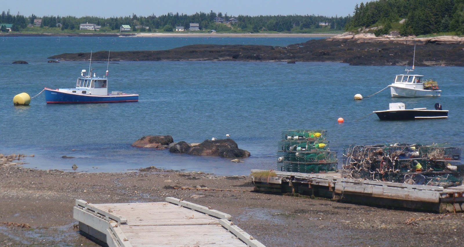
We arrived at 8:30AM, just after high tide.  We headed down Bridge Street, which leads to the bar which gives Bar Harbor its name, a sand and gravel bar between Mount Desert Island and Bar Island.  A new lime green sign cautioned us that parking is not allowed on the bar.  Any temptation to park on the bar was negligible at that hour, as Bridge Street dead ended right into Frenchman’s Bay, with barely room to turn a car around.  We offloaded our kayaks and lined them up tightly against a stone wall.  Then Mark headed off to find one of the few street parking spaces left.  (Morning whale watches leave at 8:30 so the streets fill quickly.) 
Backing down, as Mark drove up, was a trailer full of tandems headed out on tour.
The bar at high, this couple awaits their tour, Mark's boat peaks out by their feet.
Much of the area between Bar Island and Mount Desert Island (MDI- the island with Bar Harbor and other towns on it) drains out by low tide, we took advantage of the high tide to cross over that land, passing by a different set of tandems, this nicely grouped set one which had probably launched from the Town Docks. 
Guillemots were in abundance near the cliffs, the spring weather must have been favorable for them; good for those who enjoy watching dangling red feet taking flight, and bad news for their prey.
Guillemots on rocks

Wind and swells were slight.  The Porcupines are lovely on still days, since we can explore the inlets and keys.  They are impressive in swell, since we can watch waves crash against the high cliffs.
Interesting fracturing on one of the Porcupines
We stopped at the Hop to free what must have been a suicidal attack periwinkle from Mark’s skeg box.  The tombolo between Long Porcupine and the Hop was completely underwater, and the beach pretty small. 
Clear paddling between Long Porcupine and the Hop

We wandered the beach, gathering some drifted trash and taking a few close-ups.  
Water moves over the tombolo
Then it was off to Ironbound.  A few of the inlets seemed tame enough to peek into.  A few cautions to consider should you consider doing the same:  think ahead of time about rescue options should anything go wrong; having a throw rope ready might be a good idea.  Watch the opening through the duration of a few swells to see the pattern inside.  Keep someone outside to watch for passing boats (and their wake) or a change in the wave pattern.  I’ve heard that you should back into caves, since it allows you to keep a good watch on incoming swells, keeps you cautious and makes it easier to get out. 

I never know which, if any, caves will be accessible, some are better at higher tides, others at lower, and they all depend on the direction and amount of sea swell, as well as what other boats are in the area.   A fishing boat filled with a family casting lines puttering surprisingly near the ledge meant one stretch was unavailable.
At the base of a cliff on Long Porcupine
On the way back we stopped at Rum Key for a snack (having promised ourselves Geddy’s Pizza for lunch.)  No surprise, before we left another kayak tour landed for their break. You can see them there in the top photo.  And what a beautiful place for a snack!  
At the channel between Burnt and Sheep Porcupine several harbor porpoise were feeding.  A few surfaced right beside Mark, but were gone by the time a camera was out.
It's easier to get photos of seagulls than porpoises
Coming back to the Bar, especially now that it was fully exposed, was an exercise in contrasts.  We’d been by ourselves at the Hop, seen no other kayaks beyond Rum Key, but on shore we were in the midst of explorers speaking a polyglot of languages.   I think it’s wonderful to see so many people outside enjoying nature, looking at the sea shells, observing the sea gulls, strolling Bar Islands beaches and trails.  Another kayak tour was launching, this one, filled with young children, bounced along like ping pongs, with one tandem continually grounding near the bar.  Strangers passing by took pity on the wanderer, wading into the chilly waters push it to deeper water. 
Cars were parked three rows deep at the end of Bridge Street, parked in what they apparently defined as “not the bar”, though it would be underwater at high.  Threading our SUV down Bridge Street, through the cars, walkers, dogs, motorcycles and bikes was a challenge, and making our way downtown along the narrow streets through the construction area was equally entertaining. (And this on a day without a large cruise ship in the harbor.)  But Geddy's pizza was worth it.
Bar Harbor is justly famous for its amazing vistas and access to nature. Though we spotted several groups, that was over a couple hours and several miles, each group was visually by itself.  These paddlers were lucky to see those incredible islands up close, to watch the guillemots fly from sea to high on the cliffs, to note the eagles soaring above, to spot seals and porpoises, to smell the salt air and paddle through seas of lobster buoys.

Monday, July 25, 2011

Castine - Heat Break

Basics:  Launched from Castine Town Dock, parking limited to 3 hours.  Restroom available. High 5:30AM, Launch 8:30AM finish 11:45AM 8.2 miles.
The smokestack on the Maine Maritime training ship "State of Maine"
Last week: hot, hot, hot, humid and hot, hot, hot. Baffinpaddler posted a good guide to staying cool while kayaking, to which I would add only that mornings tend to be cooler than evenings. Even so, one morning we woke early to paddle on the river, and in preparation I soaked the long sleeves of my rash guard before leaving the house. We walked down the hill and paddled a couple of miles, and in the moist morning air the sleeves were just as wet as when I put the shirt on. There’d been no evaporative cooling at all.
So when Sunday was promised to be cooler, we made plans to go to Castine, counting on an early start to increase the odds it would be cool enough to paddle.
It was a mere 73 degrees when we launched at 8:30AM, and not hard to find a parking space.
The waters were fairly busy though, sailboats and other pleasure boats headed out, this windjammer headed in.
Motoring by Dyce's Head lighthouse
The schooner came from the protected harbor behind Nautlius Island. A number of boats take advantage of those quiet waters to anchor overnight.
I like the way this ledge, near Holbrook, echoes the distant Camden mountains
With a fair wind from the north we paddled by Nautilus, along Holbrook Island  and over to Harborside, before turning back into the wind, paddling between Holbrook and Brooksville, then back along the outside of Holbrook to a favorite beach, filled with rounded rocks.
Finally back through the choppy windswept waters to the town dock, just a short paddle, but a joy to be out in cooler weather.
Seal lovers might be happy to note a number of seals lingering on ledges near Ram Island
Meanwhile the Victory Chimes now had its sails aloft and was headed out for the day. Victory Chimes is a three masted schooner out of Rockland, and if it looks somewhat familiar it’s because it graced the reverse of the Maine State quarter .
Congratulations to Mike, the Durhamblogger for helping out in Louisiana during this hot, hot week!

Friday, July 15, 2011

Beals Island Maine


Basics: Launch Beals Island, Alternative Jonesport. Moderate parking, tough ramp at low tide. Portapottie. Best paddle for mid to late summer, on a Sunday. Launch 9AM, finish 1:30PM low 1:30PM, 11.8 miles

6:30AM on a Sunday and I was up and ready to go. We were headed to Beals island, a site we visited first last winter while checking out their giant Trap Tree. The water off Beals looked so inviting, full of islands and ledges, surrounded by an archipelago that we knew we wanted to head back in the summer to paddle. But it also looked like a serious lobstering community, traps piled high in every yard. The ramp lots were small enough that we didn’t want to interfere with anyone who needed parking. So we planned a trip for Sunday, a day when traditionally little lobstering is done (though there are no rules about not lobstering on Sunday).
We used all of our guide books to help plan our adventure, but especially Kayaking the Maine Coast, by Dorcas Miller, which does a great job of describing island ownership. She also reminded us that fog was a significant risk in the area, something we knew from our past experience of attempting to visit Halifax Island off Roque Bluffs. That took two separate trips up, as the first was too foggy, and filled with boat noises to attempt a crossing.
But this day we were lucky: a bit over two hours after departure we arrived to clear skies and just enough wind to keep things cool. Just before 9AM and we were the only car in the lot, though some trucks were parked by a nearby wharf. It took a few minutes to orient ourselves, it turns out the launch wasn’t where we remembered it being, but a nearby spire in Jonesport helped us find our place (The spire is peeking up in the right above).
From there we were off, crossing the extremely narrow channel to Pig Island and soon we were in Eastern Bay.
Two boats in the Harbor, Pig Island behind
Eastern Bay is filled with seals. Every ledge seemed to have 20-30 seals on it and more could be heard barking on distant ledges. As a result we tended to stay between ledges, rather than sticking close to shore. Fortunately, there were very few boats out.
The blurry blobs at the bottom are seals
We piloted along, double checking against the chart. In a new area with so many ledges and islands this was a good review of navigation skills. We spent a fair amount of time debating which distant blobs of lands had which names. At one point we even had to paddle out to a can buoy to verify our actual position.
Heading for Black Island
On a dropping tide we were able to get between Black Island and Steele Harbor Island and headed out through Head Harbor to the open water. We did this knowing there would be big water and confused currents, an assumption which was reinforced by waves crashing against the sides of the opening.
Head Harbor, crashing surf by Man Island
Sure enough, outside the archipelago we found ourselves in big swells, not huge, but enough that we found ourselves paddling uphill alot. The challenge in getting out in water like this is that paddling into waves, up the front and down the back is easy. It’s going sideways or with a following sea which is more difficult. We’d been through a surf zone once this season, while off Cape Cod, so we felt confident we could paddle through surf, should it develop, and at least make it back the way we’d come. In the meantime, being out in these swells was exhilarating, but also quite humbling; an instant reminder of the difference between day trips in protected areas and any trip in exposed coastal conditions.
As we paddled up and down, a skiff buzzed along outside us, popping in and out of view. Meanwhile a lobster boat headed our way from out by Mistake Island. We watched the boat carefully, knowing we were probably not very visible to the lobsterman, assuming he was even looking and not distracted by some work on his boat. We did what we usually do in these situations, gathered close, moving slowly, but keeping our paddles in full motion (moving paddles are much more visible than stationary ones). As the boat continued on by Main Channel Way, and was still pointed straight for us, I was reminded of the hypothetical situation often given for the Maine Guide exam, where a client goes missing after a boat passes through. In these waters, where breaking waves were keeping us some distance offshore, that would be a disaster indeed. But fortunately, there weren’t six large tandems in our group, just the two of us, in nimble single person kayaks, so it was an easy process to move out of his way, further off shore. He waved as he went by, and we waved back before continuing southwest.
We lucked out too, in that Main Channel Way was quite calm. There were confused waters toward the outside, a result of waves echoing between the rocky shores, but no breaking water, and soon we were back on the calm inside waters.
Glass like conditions inside (note Mark's boat is backward)
We stopped on a sandy bar between Knight and Mistake Islands for lunch. When we headed back along the western edge of the bay, I was reminded of another important lesson. My skeg no longer worked and I had to return to shore to work a rock out of the skeg box. Mark always drags his boat backwards along the shore to prevent that from happening.
Looking out toward Moose Point, the dark swell lines look pretty insignificant
Two black backs fight over a crab
One will be the victor!
I loved these little houses on tiny islands.
And yes, seals really do lie on their sides (again it is a blurry shot because we are keeping our distance.)
There were many fish pens marked on our charts. On the way out we hadn’t seen any, but this pen was still active off the Spectacle Islands.
We made it back to the ramp at about dead low. From my landing spot, I had some mud to tromp through before getting to solid ground. Mark paddled further onward, but still had a tough time landing on the rocky surface.
There were a few more cars in the lot, but not many, so I think paddling on a Sunday was a good idea. During our trip we only saw one seal pup. But the next time I paddle here I’ll probably wait until even later in the summer, to be sure the seal pups are fully grown.

Wednesday, July 6, 2011

Mere Point - Brunswick Maine

Basics: Launch Merepoint Neck; fairly empty when we paddled but with signs implying it is jammed and busy. Two outhouses, No Overnight Parking.


Trip 2: Out via Birch and the Gooses, in via Bustins, Williams etc 9.3 miles, launch 8, finish 11:45, 30 minute break. High about 1PM. (This was the second half of our trip south to Bath. After an overnight stay, at the elegant Parkwood Inn, we wanted to paddle on more open salt water. )

Casco Bay is noted for its fingerlike extensions, dripping out to sea. On this trip I hoped to explore coves and islands and perhaps enjoy increasing swell as we worked our way west.

Typical view from the islands of Casco Bay
I planned our paddle from the public launch at Merepoint Neck because not only did the MITA guidebook state it was an all tide ramp, but also it did not caution that parking was extremely limited. However, everything at the launch implies it gets very busy. There are signs limiting time on the ramp to 30 minutes, prior to arriving at the ramp there are pull-outs in which to ready your boat. Another sign cautions boaters to form two lines and to wait until their side of the ramp is free to launch. Hand-carry boats are given a second pull-out area near the top of the ramp, presumably we should carry the boats down from there. We’d brought along our carts and just towed the boats from where we parked. And on the evening of Jun 30 and the morning of July 1, the area was pretty quiet.

As we went to launch in the morning we noted another sign, this one cautioning us of airboats in the area. And sure enough an airboat soon pulled up to the ramp. We had a pleasant talk with the friendly outgoing men waiting on the boat for their trailer to pull down. They were clammers, and loved the access of the boats to clam flats. When we mentioned bottoming out while crossing between Birch and White, they laughed and said they didn’t even need water to make it through there.

Another difference between Casco and Penobscot Bay was in the lobster buoys, long handled buoys seemed the norm on these waters.


Despite the many boats moored in the bay, most of our crossings had little traffic. We crossed over to Birch, and glided along the turn of the century cottages, then paddled along the eastern edge of Upper and Lower Goose. We spent some time on a MITA island, admiring the rocks and shells.
Interesting granite

View out to sea

Shore full of periwinkles and whelks
By the time we were ready to leave, another group had arrived and, like us, they were amazed that on this gorgeous bright day before the Fourth of July weekend the bay was so quiet.

From the Gooses we passed to Bustin, home of one of my favorite cottages, this delightful octagon house perched on an outcropping. It shows on the chart as a circle labeled “house” just off shore in the blue.

From Bustins it was back along four smaller islands to the landing. The seas were quiet, and the wind negligible along the trip, making these waters calmer than the Kennebec had been the day before.

Trip 1: An evening paddle out to Birch and attempting to pass through to Little Birch, along White and back to the launch. Launch 4.45PM, low 6PM, finish 6PM 3.8 miles.

After our paddle on the Kennebec River we checked into the Parkwood Inn, reveling in their showers before heading out to the Flip Side for some incredible pizza, then, because I like paddling at low tide, we headed to the Merepoint Landing. Knowing we were headed out to the Goose Islands in the morning, for this evening paddle we planned to either putter along the interior harbor, or circumnavigate Birch.

We easily made it to Birch and it looked like we’d make it between Birch and White to Little Birch. But about halfway through the green area on the chart (which is above water at low tide) we began bottoming out. Mark tested the bottom and discovering it was muddy, chose to quickly head back the way we came rather than wading through. We were just a little too late, perhaps if we’d skipped the second slice of pizza, or hadn’t wandered through the Tontine Mall trying to discover why a fiberglass kayak was mounted outside we would have made it.

Marshy low water was pretty much the story after we left White Island heading back to Merepoint Neck. The water was shallow and weedy, with not much on the bottom worth viewing.

There are dozens of boats moored off Merepoint Neck, including this lovely wooden cruiser.

It was a pretty paddle, and very mellow, the wind had dropped off, the sky was mostly gray and quite peaceful, but as low tide paddles go it was pretty bland; no starfish, no sea urchins, no sand dollars.

At the hotel I found a Pamplet called Coastal Harpswell Maine listing several more launch points, but no details about access, parking etc. See also harpswellmaine.org

A long way up the ramp at low tide

Saturday, July 2, 2011

Kennebec River Bath, Maine – City of Ships


Basics: Bath Town Landing South. Washington St Street, Bath Outhouse, Sufficient Parking. High noon, launch 10:00AM, finish 1:30PM, including 45 minute break, 8.3 miles. Watch for current in river.
A return to Mark’s boyhood haunts along the Kennebec River; days of freedom and exploration, adventures in a 13 foot canoe including getting caught in the current near Doubling Point Light and barely making it home. He hoped to revisit many of those sites, and I hoped to avoid becoming another story of near tragedy. Not that we were aiming for any of the danger sections of the Kennebec, the mouth, Upper and Lower Hell’s Gate and the Chop below Merrymeeting Bay, but even the long stretch along the city can get significant current.

Mark planned the trip, paying careful attention to tide tables. We started by heading down to Doubling Point and then easily back, heading up along the eastern side, a scenic area not unlike many coastal islands.
We paddled north to Bath, occasionally discovering areas of chop. There was a steady breeze from the north, and an incoming tide, though we met several back eddies. But the irregular patches of chop was a reminder that Mark’s boyhood adventures in a 13 foot canoe were probably ill advised.

I loved this view of the two bridges, the old Carlton bridge, still in use for trains and the new bridge.

In preparation for Bath Heritage Days, (always over the Fourth of July weekend) a Carnival was being set up in the shade of the Carlton Bridge.


On July 4, 2011 they will be laying a new keel for a copy of the Virginia at the Bath Freight Shed. The Virginia is perhaps the first ship built by Englishmen on American shore, built by the desperate settlers of Popham eager to escape back to a warmer and safer of England. The 51 foot pinnace should be finished by fall, and I hope to visit it someday. In the meantime we were intrigued by this boat on display by the Freight Shed.

We lunched at the Bath Waterfront Park, watching as park workers decorated the trees with red, white and blue lights. Mark spent quite a bit of time comparing tales of old Bath with another returning visitor.


Our return was along the Eastern edge of the river, though we took special care to stay outside the buoys marking the secure area surrounding Bath Iron Works(BIW).

Much had changed over the years. There was a new dry dock (and the secure area) at BIW.
There was new park south of BIW, and the Maine Maritime Museum had grown tremendously. They offer 20 cruises weekly with six themes, plus behind-the-scenes look at BIW.

The Bath Town Landing South boat launch was also new. We didn’t pull into the landing yet, but used the high tide to explore Winnegance Creek, which becomes a bay at high tide. Winnegance Creek is shallower than the river , and has very limited current. It was the area Mark spent most of his time in as a boy. Despite all those advantages, it was still the site of many remembered disasters: then he and his brothers hadn’t been able to row back against the wind and had to have a neighbor rescue them; another time they were nearly being stranded in a mud flat in low tide. We crawled around the inlet and Mark was amazed at how much smaller it had become, and weedier. Sturgeon seemed to like the area. We saw several smaller sturgeon (about 18 inches long) jumping while we paddled over to what may have been an old saw mill beside a tide mill.
Overall it was an interesting paddle, moving water, winds and traffic, and lots of fascinating scenery, even if you don’t have someone along to regale you with tales of his youth.