Monday, September 7, 2015

Sticking to a plan, or not...


   Today's post was supposed to be pictures of the Porcupine Islands, probably my favorite place to paddle.  We haven't been there all summer, for many reasons.  One is that, to get there we need to go to Bar Harbor, which is a zoo all summer long.  Another is a longer story.

   Mark's tendinitis, which bothered him most of last year, has been more pronounced this year, so most longer kayak trips have been impractical.  We've done more short paddle board trips, which seem to bother his elbow less, and I've done lots of trips on the river. 

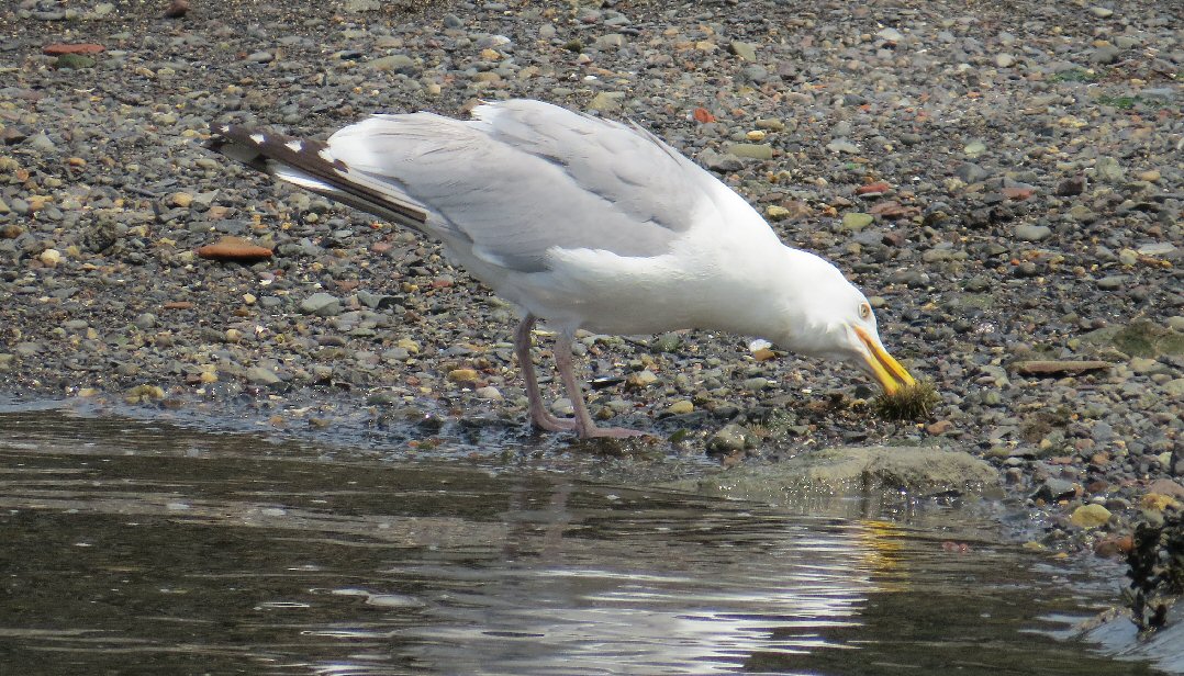
  And not much has happened on the river.  For a few weeks there was a seal pup hanging out, but no good could come from sharing that sighting, and other than that it's been the usual eagles, seagulls, ducks and crows.
Could you give away his location?
  Meanwhile, Mark, looking for exercise, has found pickleball.  Pickleball, played with whiffleballs, over-sized ping-pong paddles and a badminton-sized hard surface court seems like an odd choice for someone with "tennis elbow"  but he swears it's different muscles. 

  He started playing one day a week, but quickly ramped up to a five day a week program.  Then he began encouraging me to come along.  "Anyone can play!"  he claimed, "You can play at any level."
Ledges near Ram Island

  And so, one day I found myself on the court.  "Just lob the ball over the net,"  he coached.  So I did.  In short order, my opponent (not Mark) slammed the ball back.  It crashed into my knee at 40 mph. 

  "Anyone can play"  but not anyone can play well.  Mark has an advantage, having played ping pong for many years. Other pickleball players come from tennis, racketball or squash backgrounds.   I hadn't done any of those, though I had played badminton as a kid. (in our neighborhood we used a volleyball net to play, I was utterly shocked when my kids started playing to discover the net was only supposed to be 5 feet high - none of my skills seemed to translate to this new net.)  

   There are generally four players to each game.  In the non-competitive practice I went to,  a game lasted about 15 minutes, and the players got switched around after.  For a beginner, that's good news, because the people playing with you aren't stuck losing all night.

  Pickleball is known as a social sport, after each game we get to chat.  And the court is small enough that that we can talk during the game.  There's a lot of support at the game, from hints on playing better, to congratulations on a good shot.  I think I got my first congratulations when using the paddle to block my face, resulting in the ball actually going back over the net.  Then there are "Good games" all around at the end.

  Mark, as it turns out, is pretty good at pickleball.   They call him "The Wall", as in "No one gets past The Wall."  They call me "The Sieve."

  There are many good things about pickleball.  It is social, if you don't want to play the same game all the time, you have to find new people.  One day a group of woman came down from Grand Manan Island seeking new opponents (victims).  It helps us exercise, and lose weight.  We lose weight primarily because we can't eat before we play, if we have any hope of moving fast enough to get the ball.  And, once we're done, what we crave more than food is water, more water, and icy water.

  So, in addition to working around work schedules, and planning shorter kayaks trips, we've also been working around pickleball.  Today, Labor Day was supposed to be reserved for a trip to the Porcupines.  Then a few weeks ago, a pickleball tournament was announced for Saturday.  Mark was quickly snapped up for a men's double team.  And eventually, someone convinced me to be their partner.  Mark's team came in second.  Ours didn't place quite that high.  But even with the tournament, we were going to save today for the Porcupine trip.

  Sunday, Mark and I found ourselves paddling on the Penobscot.   Mark had pulled a few muscles in his games, but he felt sure he could do a Porcupine run.  "I'll just stay away from rock gardening and bracing." 

   It can be hard to resist the lure of popping into keyholes, but it's certainly possible.  But, I'm not sure I could guarantee that Mark wouldn't have to brace.  I can't control the weather, or the wind.  I can't promise there wouldn't be confusing waves.  Especially not if we were going by the cliffs, and if we weren't going by the cliffs was it really worth it to face the Bar Harbor mobs?
 

   So instead we went to Castine, where the harbor and islands interact to protect the water and assure there's probably a calm route back to the launch.  Because making sure the water is within your capabilities is something you need to determine before you find yourself 3 or 4 miles offshore.


   And to tell the truth, it was a wonderful time in Castine, with some amazing scenery; it is hard to imagine a better day!

   The seal pup picture was taken on the Penobscot River in the spring, the rest were from Castine, today.

  Details for trip planning can be found in earlier posts
     Some prior Castine Trips:  Halloween Tour, Best Laid Plans, We do have a plan (Castine is apparently our top choice for plan related blog posts)
     Some Porcupine Trips:  Porcupines AgainPorcupines Islands in Late September, Seven Reasons to visit the Porcupines.


Monday, August 3, 2015

Ladle Loop, South Addison Maine


  Ladle is one of many appealing islands off the Maine coast.  Though access is not allowed, its high cliffs with golden lichen draw the eye and begged for closer examination.  Ladle is built the reverse of many islands on the Maine coast.  Most islands have their rockiest shores to the south-east, but on Ladle the cliffs face to the north, visible from just after our start at the South Addison launch.

  The South Addison launch was about half full when we arrived at 10AM on a Saturday.  There were several vehicles with trailers, including a commercial kayaking tour vehicle.  Our plan was to paddle around some islands then make it to the Cape Split causeway for the 12:15 high tide,  portage the narrow road to get back into Eastern Harbor, and return to the launch.

  On the way out of the harbor, we captured a decent picture of the ersatz lighthouse.


  Freed of the harbor, goal one was Ladle Island.  It's a short three-quarter mile crossing, and it seemed like most boat traffic preferred to stay outside the Ladle-Norton island area, perhaps because of the many ledges. None of the ragged cliff edges revealed paddle-able caves.

At the base of the northern cliffs
   But we did get to admire the golden lichen.


  The island looks more like a ladle from this angle (to the southeast).


  Many guillemots swam about the island; I have no doubt that several nest on Ladle.  One last picture of the east side.


  Then it was off to Norton and Eagle Islands. About halfway there we happened upon a jellyfish bloom.  I assume the moon jellies were torn on one or more of the many area ledges.


  Here I'm puttering by one ledge near Norton.  Our chart showed a day-marker warning of the outer edge of the ledges, but we weren't able to spot it.  Turns out our chart was out of date - it's been replaced by a nun buoy - which we did see.


  This is a nice picture of tiny Eagle Island, just north of Norton (left in the photo.)   As we paddled up to it, suitably enough, not just one, but two eagles flew in, paused in the trees for a second, then took off for another location.


  Lunch was on Sheep Island, owned by the Downeast Coastal Conservancy.  It is a lovely island, with a sandy shell-strewn beach, picnic table, fire pit and latrine.

Beach closeup

  We chose to eat at a shady spot on the beach, where diving terns kept us entertained as we ate.


  Another tern picture, this one with a young tern begging for food.

  The causeway crossing was fairly easy, although I did wind up slogging through some red seaweed.  A slightly lower tide, or not being there at precisely high might improve that, but I'm not sure how it would affect access to Eastern Harbor.  The whole northern quarter dries out by low...


Exploring the peaceful harbor waters

   These residents on Eastern Harbor believe in keeping life fun.


  As did several others! We counted nine kayaks in the harbor.  (Not that you need to kayak to enjoy life, but it certainly helps...)  We never did spot the commercial tour, so I assume they left Eastern Harbor to explore islands.
A close to full Eastern Harbor as viewed from the launch.

Summary:  Launch South Addison, lots of parking, all tide ramp.  No facilities.  High 12:15PM.  About 6 miles, start 10, finish about 1PM, one stop.

Thursday, July 30, 2015

Racing low at Naskeag (Maine)

Looking from Pond Island to Blue Hill Bay Light on Green Island

  As I sit in the basement, trying to get my brain to think on this hot, sticky day, it's hard to remember how cold it was last Saturday.  61 degrees (F)  with a light but steady wind from the east and iffy skies.  So of course we headed to Naskeag, a launch site from which we regularly get caught in fog or rain.

   But we go to Naskeag for multiple reasons; you can get to islands without crossing any channels,  it's easy to get to and rarely crowded,  and most importantly, there are so many wonderful places to go if it is clear enough

  There is plenty of parking for cars at Naskeag Point in Brooklin Maine, but less for vehicles towing trailers.  Some trailers parked on the beach (a firm crushed granite beach), some along side of the road, a few placed a trailer in one spot, truck in the other and one took up four or five spaces.

  Though the skies were gray, there was no fog, so we headed across to Pond Island, passing on the way Mahoney, a active bird island.  In addition to the variety showing up in the picture (cormorant, gulls, eiders) terns, guillemots, and loons hung out by the island.


  Our crossing took us to Opechee, then it was a matter of seeing if we could beat low to cross between Opechee and Jons, and again between Opechee and Black.  The water was just passable between Opechee and Black.

   Over 100 seals were spotted on various ledges.  This shot is of a crowded ledge east of John's Island.


   Only one raccoon was scene, running free on Opechee.


   Lunch, at just about low, was on Pond Island, before riding some choppy water back to Naskeag.

Another picture from Pond Island

  Summary:  Launch 10:30AM, low just about noon, finish about 1:30.  8 miles, one break.   Naskeag offers about 20 single car spaces, trailered vehicles tend to part on the side of the road.  Port-a-pottie.   All tides crushed rock ramp, dock, also a nice picnic area and beach at the launch.

Wednesday, July 22, 2015

Moose Neck, South Addison, Maine


South Addison has a really nice ramp out on Moose Neck.  It's large, all tides and has plenty of parking. We were there on a Saturday in early July, and not very many spaces were taken.  The ramp leads into Eastern Harbor, a very protected area, with a few scenic lobster boats.


  In addition to moored boats and wharfs, the harbor seemed to have a goodly supply of moon jellies who'd made their way in and seemed ready to stay for the summer.  Across from the ramp, on Cape Split an artifical lighthouse peeked out from behind some trees.  Further out, to the southwest and behind scenic Ladle Island, was a more formal lighthouse on Little Nash, though checking the chart, we learned that lighthouse was abandoned.

Ladle Island, looking quite appealing.  The abandoned lighthouse is barely visible to the left.


  We weren't headed west though, but east into the smattering of islands by Tibbets Narrows.

A bell buoy and multiple islands - what could be better?
  There we encountered a Bell Buoy, always a favorite sighting,  and in the distance, ledges full of sunning seals.

Distant shiny seals decorate Hay Ledge

   We paddled by Plummer's Islands, looking to see if we might make it between the two, but it was well past time for that crossing.   Then it was on to another chain of islands, taking a break upon Stevens.  I can't help but feel our landing would have been more pleasant at a slightly higher tide, but the shoreline was mostly solid, which just a couple patches of  mud.

Two boats on Stevens Island

  And dashing about, nearly hidden by their coloring were several tiny sandpipers, which we've identified, tentatively, as least sandpipers.  Two pipers are plainly visible in this photo.


 But on the island, the birds appeared more as brown blurs against the landscape.  This photo has a seven or eight blurry birds in it.


   After Stevens we headed for Duck Ledges and then back between Tibbett Island and Moose Neck, before returning to the launch.  South Addision was a new launch for us, I'm sure we'll be back to explore the area some more.

Summary:  Launch 10:30AM, Finish 12:30PM, Low about 1:20PM.  Lots of parking, concrete ramp, no facilities that I saw.  7.5 miles with one break.


Tuesday, July 14, 2015

Welcoming the Hermione to Castine


Crowds fill Fort Madison, and all other access points along the harbor
"Vive la France!"  the cry came up behind me from the crowd at Fort Madison.

 When was the last time Castine harbor heard that cry?  Maybe in the mid 1600's when Baron Castin was still in residence.  Then the cry might have come from Fort Pentogoet, located near where Our Lady of Holy Hope is currently located, as soldiers saw ships coming in with new supplies.

   Certainly that cry had not  been heard from Fort Madison, a U.S. fort built in 1809 to defend against another English capture of Castine.  When Castine was again attacked in 1814 by the English the poorly staffed fort made one token shot, spiked their cannons and disbanded.

Arriving out of the mist
  But on July 14, 2015, the cry was to honor a visit from the Hermoine, a replica of the ship on which Lafayette sailed to America in 1780, bringing with him crucial military strategies used during the Revolutionary War, and more importantly,  support for an independent United States from an established European country.

  It was the perfect day for a ship to visit.  There was light fog on the water, making it easier to transport back in time to when sailing ships ruled the seas.

The side of the canoe reads:  "Water is a blessing for all life."

  We'd arrived at Wadsworth Cove at 1PM, and launched from there to the harbor, it was about three when the ships began to enter the harbor.  We'd passed our time paddling up and down, and chatting with other folks in small boats, including Reinhard Zollitsch, who along with making several long canoe journeys has also helped race sailing schooners.


  It wasn't only the Hermione that arrived, but a whole flotilla of boats, everything from schooners and yachts to dories and kayaks.
The second boat appears to be a sailing diesel yacht

   Some ships announced their arrival with cannon fire, others with honks or fog horns.   A very festive event; though it might be fair to state it was also a bit zoo-ey and many kayaks seemed to disregard any guidance about taking care near large boats.

  But to see such a grand ship sailing - what can you say but "C'est magnifique!"


More about the Hermione
More about the Hermione visit in Castine   Several streets in Castine have been set up as temporary one way streets to allow for more parking.  Even so, it seemed like every spot was filled when we left....
 

Monday, July 13, 2015

Friar Bay, Campobello Island N.B.

Mulholland Light to the left, Lubec to the right
  We went to Friar Bay to enjoy a low tide paddle.  Actually, we came to the Lubec/Campobello area to enjoy low tide, then decided once we were there that the best way to see low tide was from the water.  So we crossed to Campobello Island and looked for a place to paddle.  We had our passports with us, and they were checked both ways.  Campobello Island may only be connected by a bridge to Lubec, Maine (and to the rest of New Brunswick by a seasonal ferry) but don't expect customs to ignore your crossings..

  Friar Bay was recommended by the information center as the place where they paddled, and conveniently it was quite close.  It's a broad open bay, with a nice rock/sandy bottom.  Friar Head and a sea stack are located to the southwest side of the bay.  Friar Bay is where Franklin Roosevelt used to anchor his yacht when he came to visit his summer residence on Campobello Island.

  We paddled off to the sea stacks, going by several sights on the way.  A couple abandoned boats, one old, one newer.

 There's a nice dock, which I think must be associated with  Roosevelt Campobello International Park, though I don't see anything about it on their site.


Some sort of aquaculture marked by yellow buoys.


  The sea stack looks most like a friar in this photo.

  And lots of wildlife, several sightings of ctenophora,  include a ribbon-like cestid comb jelly.  There were also  more than a few jellyfish.


  Lots of sea stars, and urchins.  (They were mostly on rockier shores)


  This sea gull gets to enjoy an urchin.


  Sand dollars freckled across the floor.

  We paddled down to Mulholland Lighthouse.  The narrows under FDR bridge are marked as hazardous for navigations because of the fast currents there mid tide.

   Out along Friar Bay, though, the water was peaceful and quiet, with plenty of time to observe the ocean floor.  We arrived back nearly at dead low, with quite a bit more sandy bottom to cross to return to our cars.


Summary:  Launch  Friar Bay Beach, adequate parking, no facilities.  There is an information center about a mile away.  We launched at 10:30 EDT, finished at noon.  Low was at 12:40.   About 3.5 miles. We headed back to Lubec for lunch, where we captured one of my favorite shots of the day, looking back toward Mulholland Light.