Showing posts with label Beals. Show all posts

Friday, July 15, 2011

Beals Island Maine


Basics: Launch Beals Island, Alternative Jonesport. Moderate parking, tough ramp at low tide. Portapottie. Best paddle for mid to late summer, on a Sunday. Launch 9AM, finish 1:30PM low 1:30PM, 11.8 miles

6:30AM on a Sunday and I was up and ready to go. We were headed to Beals island, a site we visited first last winter while checking out their giant Trap Tree. The water off Beals looked so inviting, full of islands and ledges, surrounded by an archipelago that we knew we wanted to head back in the summer to paddle. But it also looked like a serious lobstering community, traps piled high in every yard. The ramp lots were small enough that we didn’t want to interfere with anyone who needed parking. So we planned a trip for Sunday, a day when traditionally little lobstering is done (though there are no rules about not lobstering on Sunday).
We used all of our guide books to help plan our adventure, but especially Kayaking the Maine Coast, by Dorcas Miller, which does a great job of describing island ownership. She also reminded us that fog was a significant risk in the area, something we knew from our past experience of attempting to visit Halifax Island off Roque Bluffs. That took two separate trips up, as the first was too foggy, and filled with boat noises to attempt a crossing.
But this day we were lucky: a bit over two hours after departure we arrived to clear skies and just enough wind to keep things cool. Just before 9AM and we were the only car in the lot, though some trucks were parked by a nearby wharf. It took a few minutes to orient ourselves, it turns out the launch wasn’t where we remembered it being, but a nearby spire in Jonesport helped us find our place (The spire is peeking up in the right above).
From there we were off, crossing the extremely narrow channel to Pig Island and soon we were in Eastern Bay.
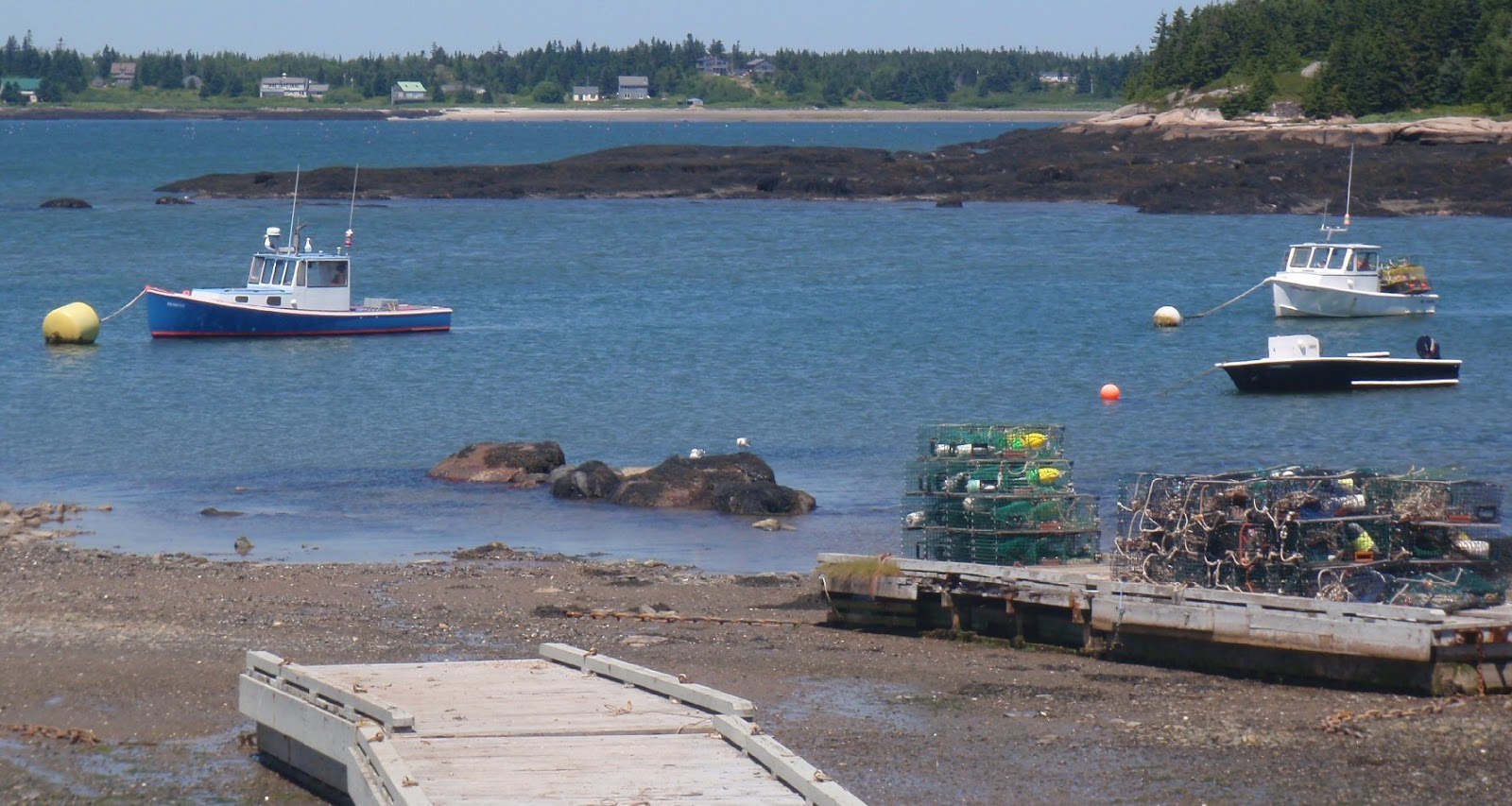
Two boats in the Harbor, Pig Island behind
Eastern Bay is filled with seals. Every ledge seemed to have 20-30 seals on it and more could be heard barking on distant ledges. As a result we tended to stay between ledges, rather than sticking close to shore. Fortunately, there were very few boats out.
The blurry blobs at the bottom are seals
We piloted along, double checking against the chart. In a new area with so many ledges and islands this was a good review of navigation skills. We spent a fair amount of time debating which distant blobs of lands had which names. At one point we even had to paddle out to a can buoy to verify our actual position.
Heading for Black Island
On a dropping tide we were able to get between Black Island and Steele Harbor Island and headed out through Head Harbor to the open water. We did this knowing there would be big water and confused currents, an assumption which was reinforced by waves crashing against the sides of the opening.
Head Harbor, crashing surf by Man Island
Sure enough, outside the archipelago we found ourselves in big swells, not huge, but enough that we found ourselves paddling uphill alot. The challenge in getting out in water like this is that paddling into waves, up the front and down the back is easy. It’s going sideways or with a following sea which is more difficult. We’d been through a surf zone once this season, while off Cape Cod, so we felt confident we could paddle through surf, should it develop, and at least make it back the way we’d come. In the meantime, being out in these swells was exhilarating, but also quite humbling; an instant reminder of the difference between day trips in protected areas and any trip in exposed coastal conditions.
As we paddled up and down, a skiff buzzed along outside us, popping in and out of view. Meanwhile a lobster boat headed our way from out by Mistake Island. We watched the boat carefully, knowing we were probably not very visible to the lobsterman, assuming he was even looking and not distracted by some work on his boat. We did what we usually do in these situations, gathered close, moving slowly, but keeping our paddles in full motion (moving paddles are much more visible than stationary ones). As the boat continued on by Main Channel Way, and was still pointed straight for us, I was reminded of the hypothetical situation often given for the Maine Guide exam, where a client goes missing after a boat passes through. In these waters, where breaking waves were keeping us some distance offshore, that would be a disaster indeed. But fortunately, there weren’t six large tandems in our group, just the two of us, in nimble single person kayaks, so it was an easy process to move out of his way, further off shore. He waved as he went by, and we waved back before continuing southwest.
We lucked out too, in that Main Channel Way was quite calm. There were confused waters toward the outside, a result of waves echoing between the rocky shores, but no breaking water, and soon we were back on the calm inside waters.
Glass like conditions inside (note Mark's boat is backward)
We stopped on a sandy bar between Knight and Mistake Islands for lunch. When we headed back along the western edge of the bay, I was reminded of another important lesson. My skeg no longer worked and I had to return to shore to work a rock out of the skeg box. Mark always drags his boat backwards along the shore to prevent that from happening.
Looking out toward Moose Point, the dark swell lines look pretty insignificant
Two black backs fight over a crab
One will be the victor!
I loved these little houses on tiny islands.
And yes, seals really do lie on their sides (again it is a blurry shot because we are keeping our distance.)
There were many fish pens marked on our charts. On the way out we hadn’t seen any, but this pen was still active off the Spectacle Islands.
We made it back to the ramp at about dead low. From my landing spot, I had some mud to tromp through before getting to solid ground. Mark paddled further onward, but still had a tough time landing on the rocky surface.
There were a few more cars in the lot, but not many, so I think paddling on a Sunday was a good idea. During our trip we only saw one seal pup. But the next time I paddle here I’ll probably wait until even later in the summer, to be sure the seal pups are fully grown.

Sunday, December 5, 2010

A Tale of Two Trap Trees

We have been inundated with trap tree news this fall. A trap tree is a Christmas tree made by piling up lobster traps (some places call them lobsterpots.) Rockland, which has built a trap tree since 2003, held two lighting ceremonies this year. One in Mid November, filmed for a 2011 Discovery special on interesting Christmas trees, the second a week later. Meanwhile, on Beals Island, the community was working to build the world’s largest trap tree.
Being easily swayed by media, I began to feel I should actually see a trap tree live and in person. But which one: the Beals Island one, which was the biggest; or the Rockport tree, which was the original? I’ve never been to Beals Island, located Downeast of here. I’ve been to Rockland, which is just over an hour southwest on the midcoast. Rockland has a downtown filled with bakeries, restaurants, galleries and gift stores. Beals Island, as I read in Guide to Sea Kayaking in Maine by Shelley Johnson and Vaughan Smith, has Island Variety, a convenience store.
But Beals Island has another feature which is far more appealing to a kayaker: the Great Wass Archipelago, a series of more than 50 islands. It looked like there was an easy loop out through the inside of the islands, around Eastern Bay, stopping at an island with a lighthouse on it. I read Mark some of the descriptions of the islands, many of which are sea bird sanctuaries, thus off limits for much of the spring and summer. When I got home from work the next night there was a chart on the table. “That chart’s a little small” Mark explained, “I’ll redo it in two sections.” Then he added temptingly, “You know ocean water is warmer than the Penobscot now.”
Boy, that chart looked inviting. I could see the route, either from the Jonesport ramp, or from Beals Island. The ledges run all through Eastern Bay, lots of short jumps of less than a half mile. Absolutely perfect for a September jaunt. Tempting even for a late paddle, though without knowing anything about the currents, and with a destination called Mistake Island, it seemed like maybe it was best to wait.

So with reasons to see both, we decided to visit both trap trees, and scout the two locations for launch sites.
Since our first available day coincided with rain, we planned a trip to Rockland. The tree is located by the Fisherman’s Memorial and the Rockland Public Launch, 152 traps make up this tree.
The public launch is just down the hill, and the Rockland breakwater is just visible as a gray line to the left.

It is topped with a lobster holding a star, and decorated with dozens of lobster buoys.
The public launch has a small gravel beach from which kayaks can be launched. There is also a public beach nearby. My favorite feature is this nearby park filled with marine relicts.
See how the bell has been worn away by the striker
Another launch site is available further from the center of town on Snow Street, beside the Coastal Children's Museum and the Snow Marine Museum . It looked pretty empty, but the state of Maine resources guide describes it as the busiest ramp in the area.
But the real joy of this trip was visiting the downtown.
We had a nice lunch, which gave Mark a chance to make sure no work crisis had erupted. Then we went window shopping
Decorations at Seagull Cottage
I'm not sure how many bakeries exist in Rockland, 4, 5 more?
 Our next trip was up to Beals Island. The storm system had stalled overhead, so this day was also gray with a steady mist. It was a long drive there through very rural Washington County, an area where you need to be self sufficient to survive. The tree came into sight as we went over the bridge.
Not only is an island in view, but someone is working on the boat.
This is a much bigger tree, made with 769 traps, and topped with a fisherman in yellow oilcloth.
Either I've shrunken to half size, or this tree is twice as big
And it was plainly made with recently used traps: bricks and barnacles decorated the interiors.
But what was even more evident was how busy the working waterfront is in the area.
There were plenty more traps in case a larger tree was desired.

The water was filled with boats, with more on shore waiting to join in. Traps stored on shore indicated that in the summer access to launch points would be very limited, and the need to be on guard for working boats paramount.
Jonesport Launch
The Jonesport launch was described as having adequate parking, but was nearly full already. The shrimp season had just opened. The Beals launch was fairly empty, but hardly spacious and looked like it was a critical area allowing commercial fisherman access to the water.

Beals Island has a seasonal take out stand but Island Variety has been closed for years. Hikers would be interested in the trails on Great Wass Island, on land managed by the Nature Conservancy. Nearby Jonesport has some scattered stores, and is also the launch point for Norton Puffin tours. I’d hoped to eat at Tall Barney’s in Jonesport, named for a local giant. But though there were cars in the lot, it was closed, as was the nearby diner.

So we began our trip home. As we passed along route 1 in Addison a hand painted sign noted that the Bohemian Mama’s Bakery was open, and had a tiny “WIFI” lettering added. Since Mark needed to check in, we decided to stop. About a mile off route 1 at 251 Ridge Rd we came to the bakery.
No web page, but a facebook site Inside was a case full of scones, puff pastry, bars and other treats, as well as a rack of loaves and rolls. And on the counter were samples of their wood fired brick oven pizza. Delicious! We settled in at a table, and soon were splitting a pepperoni pizza. Their menu lists several amazing deserts, and has been stored away for future use. Sadly, in the winter they are open only two days a week.

So, though the Beals tree was bigger, I have to rate Rockland as the better winter experience. However, hikers looking for wild coast line would probably prefer Beals Island. And, I feel our trip to Beals Island was not wasted, the sheer number of boats there makes that a much different paddling area than I’d expected. I hope to get back there again when the weather is better, maybe after bird nesting season ends and probably on a Sunday, when traditionally lobster boats stay home. I did find that Ray Wirth had done a winter trip to Beal, which you might enjoy reading.
And I also think this proves that if you build something wicked big, people will come and spend money in your area.