Showing posts with label Camden. Show all posts

Sunday, September 9, 2012

Curtis Island, Camden, Windjammer Part 3

    "I love that lighthouse,"  I told Mark, as we rounded Curtis Island.
    "That's because it's round."  Mark replied.  We'd already paddled by Indian Island and its square lighthouse as we left Rockport.
    "And the roof is red." I added.

   I do love Curtis lighthouse; it was the November picture in my 2011 calendar, Taken By Paddling.  For this year's calendar, with a  tentative title of "Stick a Boat in it",  I was determined to get a great shot of Mark paddling by Curtis Light.  That's always a challenge on moving water, but I had to try.

  Later, after exploring Camden's inner harbor and the schooners there, we headed back to Curtis Island for a lunch break.  We'd stopped there once before, in 2007, on basically the exact same paddle as we were doing today, Rockport to Camden.  But on that day Penobscot Bay had been still, so the paddle up was a bit boring.  Also, it was low tide, and Curtis Island seemed to be filled with kayaks, so we landed on a side beach.  Good "Leave No Trace" advocates that we are, we stuck to rocky area, and didn't even attempt to scale the slope at the edge of the beach to explore the island.

   This time, with an incoming tide, there was only one gravel beach available and we had it all to ourselves.  At the beach was a set of stairs.  I might worry about the damage caused by scaling a hill, but not climbing a set of stairs.
  At the top, was a kiosk, a guest book, and a sign giving some history of Curtis island. Curtis island was given its name in 1934, named for Cyrus Curtis a long-time summer resident and benefactor of Camden.  

   The kiosk also had a sign declaring Curtis Island a public park.  So we decided to explore, hiking the wide grass trail from the harbor side to the lighthouse.

    "There's someone in the house,"  Mark whispered to me, as grew close to the lighthouse.  I continued forward, spellbound by the opportunity to see the view from the edge.
   As we hiked through the yard, a woman came out of the house.  We stopped, fully expecting to be told this was a private area off limits to visitors. 

   Instead the woman, Dee Dee Conover, had come out to invite us to climb up into the lighthouse!!!!  Heaven!  We talked for a little while about her life out on the island (note the rain barrels on the gutters for water) and then we went off to climb the tower, and she returned to her house.  To get to the top, first you climb a set of spiral stairs,

then a ladder,

After which you crawl out a window-sized opening to get to the balcony.  Curtis Light has a distinctive green Fresnel lens that can be seen six miles to sea.
The light, the hole we crawled through, and if you look carefully along the bottom, the ladder landing

   The first lighthouse on Curtis Island was built in 1836, the current structure dates from 1896.   Once you are on top of the lighthouse, you are standing 52 feet above sea level.  The views are amazing!
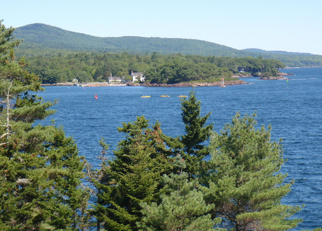
A kayak tour out by Northeast Point
The same tour group rounding Curtis: we were up there a long time.
  The lighthouse has been automated since 1972.  Starting in 1980, Garrett Elliot "Connie" Conover Jr and Dee Dee Conover began a long stint as caregivers of the island.  Connie Conover passed away in 2010, and Dee Dee is still there tending.

  The grounds and lighthouse are generally off limits to the public.  A couple times a year, Maine offers Open Lighthouse Days. September 15, 2012 is the next Open Lighthouse Day;  Curtis Light is scheduled to be open then.  Curtis Light may also be open for future Windjammer Festivals

  The entire time we were in the lighthouse, Mark and I were the only ones there.  It was a magical time that will stay with me forever.   Thank you Town of Camden and Dee Dee Conover for letting me have this magical experience!
  More Information:
  Curtis Lighthouse History http://www.lighthouse.cc/curtis/history.html 
  Curtis Island Light http://camdenmainevacation.com/curtis-island-light.php
  Curtis Island Maine http://www.lighthousefriends.com/light.asp?ID=532
 

Wednesday, September 5, 2012

Rockport to Camden for the Windjammer Festival, Part 2


   "Looks like you have a nice day for this,"  the dog walker told us, "Last time I paddled here I got thrown off my kayak out by Indian Island."  She didn't seem particularly concerned, so she must have gotten back on top readily and headed into quieter waters. 
    And we didn't probe into her accident, but spent our conversation admiring her dog and assuring the two hour parking limit didn't apply to our space. 
     Soon we were on the water.  We rounded Indian Island Lighthouse and headed north.  
Indian Island Lighthouse, an abandoned lighthouse on a privately owned island
      And sure enough, freed from the quiet harbor, Penobscot Bay waters were choppy.  Wind was from the north and the seas were interesting but not overwhelming.  There were steeper waves near the ledges to add adrenaline to our journey(watch out for rocks!), and quieter waves inside Goose Rocks to allow faster progress.
   Even before we rounded Indian Island we spotted schooners on Penobscot Bay, and once we'd rounded Deadman's Point a huge naval vessel, the 567' USS Normandy, (CG 60) came into view.  The USS Normandy was built in Maine at Bath Iron Works, and in her maiden voyage served in Desert Storm.  Since then she's been involved in many other missions to protect our country.  The USS Normandy would be our focal point through much of the paddle north.  Along the way we also saw one gray seal, dozen of guillemots and an array of seagulls.

     Camden is another beautiful harbor, a bit more crowded than Rockport. 
Heading into the maze of moorings which defines Camden Harbor
Schooners were heading out on an irregular schedule, one at a time wending their way through the narrow channel left free of moored boats.  I believe this is the Timberwind breaking free
   In the harbor, schooners were lined up along all the piers.  The three larger schooners are:  (left to right) light gray Mary Day, dark gray Lewis R French and the dark vessel is the Angelique.
Schooners, day sailers, and sailboats line up in front of Mount Battie
   Both the Appledore and this kayak group are getting ready to head out.  You'll see more of the kayak tour in our next post.
    Schooners weren't the only boats heading in and out.  Sailboats and pleasure boats headed out to enjoy the beautiful day.  The Pied Piper took passengers out to tour the Normandy.
     Kayaks bobbed about, exploring the quiet areas.  There was even a two person rowing scull.
    Once we were done exploring and watching, it was back to Rockport, stopping to admire the rock walls and sculpture at Deadman's Point along the way.
Rock Gardens at Deadman's Point
This sculpture belongs with the rock walls.
    Waves were from the northeast.  Entertaining, but not ideal for surfing.


     It's hard to say which harbor is prettier; Camden or Rockport.  I do feel like I got a calendar's worth of beautiful photos along the way.
Rockport Harbor
    As we loaded our boats we met a nice couple from North Carolina.
    "So how far did you all paddle today?"  the man asked.
    "Ten miles," Mark replied, "we went up to Camden to see the schooners."
    "Oh, we started in Camden," he offered, "But we walked here."
    "Wow, how far was that?"  I asked.
    "Two miles."

      Further evidence that the sensible thing to do if you're coming from Bangor to the Camden Windjammer Festival is to drive to Camden, find a parking space, and spend the day admiring windjammers and taking part in the many other parts of the festivities.  It's far less logical to drive through Camden to Rockport, paddle along the shore to Camden, glance at the festivities and head back.  Nevertheless we had an incredible time, primarily because the water between Rockport and Camden was so entertaining.

We offered the couple a ride back to Camden, but they wanted to explore some more, or perhaps they were leery of putting their lot in with a couple plainly lacking in common sense.

Next in the Series:  Curtis Island.

Summary:  Start Rockport Marine Park (our post on the launch), fee to launch, flush toilets, pay shower available.  Launch 8:40AM, finish 12:40PM, 10.4 miles; one long stop.  High 12:09PM.

Thursday, October 21, 2010

Camden - Sea and Lake Paddles

Camden; where the mountains meet the sea. In the summer you can sign up for kayak tours right from the town dock. And why not? The harbor is filled with schooners, yachts and sailboats, and just a half mile out is tiny Curtis Island with a lighthouse on the backside.
Our first destination in Camden was Laite’s Beach on Bay View Avenue. I wanted to explore it as a possible launch site. In season, restrooms are available there. It’s a small beach, with very limited parking, quite a ways above the water.

Laite Beach from the Harbor
“We can slide the boats down the grass.” Mark proposed, “then just carry them down the stairs.” Sure - down was easy - but eventually we’d want to bring the boats home. So we went to the official launch beside the condominiums on Sea Street. There are no facilities there and no parking, though parking is available in a nearby lot. I’ve never tried launching out of there in the summer, instead I’ve launched from Rockport, which has a much calmer harbor. In Rockport, for a small fee, you can launch and rinse your boat after.
Though it's quite late in the season, Camden Harbor was still very full.
Mount Battie and Camden Hills State Park form a dramatic backdrop to the harbor.
Camden's library as seen from the harbor.  Look for the tiny tower atop Mount Battie
Most of the schooners were wrapped up for the winter, a few were still out.
Lewis R. French prepares for winter
The Appledore was readying for one last day of cruising.
Meanwhile a frontend loader was pulling up sections of dock.
 After circling the harbor, we cruised along the south shore to Ogier Point.  Once we’d made it out behind Curtis Island the lighthouse came into view.
Closer to Curtis Island
As did some guillemots in their winter coloring.
Guillemots: alcidae with red feet which appear as blurry dots in photos
We went by the day markers, and beyond Northeast Pt. The chart shows passage behind the tip of Northeast Point. Though we were there near high, we found no openings between the rocks, but maybe on a higher high it would be passable. The tiny island just beyond the point was filled with cormorants.
We peeked around the corner then headed back into the harbor. Back at the launch a sailboat was being hauled out - a task made more difficult by a dump truck parked near the launch. We landed at a tiny beach and carried our boats over the rocks to a small turnout which was filled with piles of gravel and dirt for a construction project on a nearby road.
We’d planned to change in the car before going to lunch at the Camden Deli, not as easy a proposition with the activity around us, so instead Mark slipped on pants and I wore a coat over the wetsuit. Camden Deli, the building in the center with large plate glass windows, has an incredible view overlooking first a quiet pond filled with ducks and further out, the harbor.
Camden Harbor from the shore
We wandered the street after, admiring a 2012 model plug-in Prius, in town to impress the attendees of Pop Tech. I guess there was no plug facility available; the car was being charged by a gas powered generator.
Camden doesn’t just have a beautiful harbor, mountains, great restaurants, and fine shops. It also has Lake Megunticook, a charming lake filled with islands and inlets. There are at least four access points to the lake. One on route 105, Washington St; two on route 52, Bartlett Cove and the nearby public launch. The fourth launch is in Linconville, just off route 52 into Norton Pond, which is connected to Lake Megunticook.
A sheer cliff at Bartlett Cove reminds me of Yosemite
We launched at Bartlett Cove, a swimming beach with restrooms in season, and a portapottie still hanging out. Lake Megunticook is tucked behind Mount Megunticook which, along with Maiden Cliff, dominates the lake.
Maiden Cliff has a white cross upon it in memory of 13 year old Sarah Whitesell who was blown off the cliff in 1865.
Mark waiting patiently by the Fang
We paddled over to Fernald Neck Preserve, owned by the Coastal Mountains Land Trust. This rock by the shore reminded me of tree roots.
We took a moment to pose by a huge erratic, Balance Rock, and got rather bland pictures, then continued on along the neck, across to a small island and along the cottage filled shore.
The tip of Fernald Neck
Admiring an Island owned by the Trust, closed much of the spring and summer for nesting
The colors were still bright by the lake, and it was a beautiful afternoon to be out. Our trip had started cold enough to have frost on the car roof, but now the temperature was near 60. Unfortunately, Mark needed to get home and return to work, especially since we'd stopped by Mainesport to look for gloves and got waylaid into kayak discussions.