Showing posts with label Tales of the River. Show all posts

Wednesday, September 3, 2014

200 Years Ago - War Sails Up the Penobscot: The Battle of Hampden.

   Saturday morning, September 3, 1814 was an anxious one for the 550 men stationed by Hampden Academy.  They were there to defend the USS Adams, a damaged vessel which was currently down near where Souadabscook flows into the Penobscot.  That the 228 men who crewed the Adams had set up cannons along the wharf and on the high bluff overlooking the river and loaned their muskets to the volunteers was scant comfort.  The task of the local forces was to guard the solitary road against land attack.

   The Penobscot Bay Region had fallen to British control in the Revolutionary War.  In August of 1779 the Bangor region had seen the tail end of the failure of the Penobscot Expedition, when a few American ships had tried, unsuccessfully, to escape by making their way up the river. The region had remained under partial British control/blockade through the end of the Revolutionary War.

    In this new war, the War of 1812, one of Britain's goals was to shift the borders of the U.S., from the current St. Croix River to the Penobscot.  In addition to giving the British access to the timber in the area it would even the southern line of British territory, so it was easier to move between Halifax Nova Scotia and Quebec City.

    It had been raining through the night while militia gathered from the surrounding towns to serve under the command of General Blake of Brewer.  Even as they arrived to defend the road, They were aware that the British had recently claimed Castine and Belfast, and many felt resistance was futile. 

   Meanwhile, three miles south at Bald Hill Cove, the 750 British soldiers who'd disembarked the night before began  the march north. On the river the Britsh squadron set sail, continuing in their practice of firing shots to warn of the size of the advancing squadron. 

  It was between 7and 8 AM when the British Troops arrived at Pitcher Brook (now Reeds Brook) at the base of the hill where the militia was positioned.  At the time, a narrow bridge crossed the stream, but Pitcher Brook is a small stream, and it's likely the British could have marched through it easily.

  As the British came up on Pitcher Brook, the militia, led by Lt. Lewis, opened fire.  Two British soldiers were killed, but the rest marched on.
Pitcher Brook passes under the road by the guard rail.  Usually, the sharp dip creates more of a slow down than the stream flow.  There is a building roof at wire height which is about where the militia set up.

  The militia on the hill made a rapid assessment of the approaching troops; the gleaming bayonets and uniforms appearing through the fog and mist.  No doubt they could hear the blasts coming from the Penobscot River as well.  Either in fear or rational judgement, the line broke.  Men shed their arms and fled swiftly, in some cases swimming across the Souadabscook rather than waiting to cross the narrow bridge there. 

  North of the brief battle, by the pier, Capt Morris had seen the British squadron headed north.  He began firing upon them, until signaled from his men on the ridge that the militia had fled.  Realizing the hopelessness of his condition,, Captain Morris gave the command to spike the cannons remaining and sink the U.S.S. Adams.  Captain Morris and his crew quickly departed the area and hiked a trail from Bangor to Canaan on the Kennebec River where they found transportation south.
Some Battle sites on Google Earth

   Many men were captured and held on the British prison ships overnight.  However, the town as a whole survived.  Windows were smashed, gardens ruined, livestock shoot and a bond demanded.  No doubt 1815 became the long, hard winter the residents had feared.   British maintained rule over the region until April 1815.

A few lighter tales from the Battle:

The Kinsley house, now owned by the Hampden Historical Society, was sought by Captain Barrie to use as his headquarters.  He sent officers to her house to "request" it's use.  As they approached the house,  Mrs. Kinsley gathered the tools she had at hand, the slop buckets and chambers pots from the upstairs and, with the assistance of her maids, threw them out the window upon the officer.  One officer was later heard to remark, that if the militia had been under Mrs. Kinsley's command, Hampden would be celebrating a victory.

The children of Hampden were gathered and led away to a house on Cold Brook for protection.  However the housing there was decidedly inferior.  Girls were bedded in the kitchen, boys in the hayloft, and meals consisted of nothing but cold potatoes.  The next day the children were brought back to their parents, feeling their treatment at the hands of the British could be no worse.

  Those are cute stories, but it must have been a very trying time.  The records of the Massachusetts Volunteer Militia records this quote from the British Captain, Richard Barrie in response to a request for common safeguards of humanity, "I have none for you.  My business is to burn, sink and destroy.  Your town is taken by storm and by the rules of war, we ought both to lay your village in ashes and put its inhabitants to the sword.  But I will spare your lives, though I don't mean to spare your homes."
(Maine was at the time still a part of Massachusetts.)

Hampden has never been very proud of the brief battle.  In a direct quote from Historical Sketches of Hampden:  "For years Hampden's militia bore the majority of the blame, since several officers and three militia companies raised in Hampden were present at the battle.  A look at the records, however, will show that the militia companies of Bangor, Brewer, Dixmont, Eddington, and Orrington ran as quickly, as fast and as far as Hampden's."

And interestingly, this was not the end for the USS Adams:
On the Penobscot, by the mouth of the Souadabscook.  The pier is about where the wharf would have been.

Pretty much dead low looking south, the ship probably would have been somewhere in this area, depending on if hull work was still being done. 
               The U.S.S. Adams remained on the bed of the Penobscot River for fifty-six years; its copper sheathing quickly salvaged, but the rest undamaged.  It’s hard to imagine that forty-six years of ice freezing and thawing and high spring run-offs didn’t destroy the ship completely, but in 1870 she was raised.  Her thick oak hull was relatively undamaged and sent to Boston for repairs.  She would spend another 40 years as a Navy sailing trainer ship, sailing all over the world before being retired in 1920.  


Perhaps it is not surprising that Hampden has not chosen to officially celebrate the bicentennial of the battle - though it seems like the perfect occasion for a cross-country race (heading north).  

Sources:  A Call to Arms Celebrations Re-enactment of Battle at Hampden August 22,23,24 1980
Historical Sketches, Hampden Maine 1767-1976 Hampden Historical Society 1976.
Battle of HampdenUSS Adams 1799 Wikipedia
Sprague's Journal of Maine History 1914
Historic Shipwrecks of Penobscot Bay, Harry Gratwick History Press 2014
Maine Gravestones and Flags; Honoring our Heroes.  Emeric W. Spooner, 2010

Monday, September 1, 2014

200 Years Ago: War Sails up the River: USS Adams

      The U.S.S. Adams was a small frigate built in the Brooklyn NY in 1798.  Some sources reference it as the first ship built by the US Navy. It began its duties in the West Indies, protecting American shipping from French privateers.  After that, she served in the Mediterranean and along the US coast.
       Captain Charles Morris was given command of the U.S.S. Adams in 1813, and he was not impressed.  He felt it “insufficient for sea service” and was able to convince a naval board of his opinion.  The frigate spent several months being converted to a twenty-eight gun corvette, a process which included cutting the vessel in half and adding fifteen feet in length.  In January 1814, Captain Morris took command at the Washington Navy Yard.  His first challenge was to move the U.S.S. Adams through a British Blockade of Chesapeake Bay.   He then sailed to the south, where he captured three to five small merchantman brigs, before taking a break in Savannah in either April or May.  From there, the U.S.S. Adams next sailed to Ireland;  where additional ships were captured.  On the passage home, he was spotted and outran a total of three British frigates.
     Unfortunately, on August 17th, while passing off the Western Ear of Isle au Haut, the USS Adams struck Flat ledge.  They continued on their journey, but the presence of leaks indicated repairs were required.  So the U.S.S. Adams sailed up to Hampden, arriving on August 19th. 
      They did not arrive unnoticed - HMS Rifleman had spotted them.  The Adams had unfortunate timing with its accident as a few days later, August 26, a British squadron of battleships headed for Machias from Halifax, Nova Scotia. But hearing that the U.S.S. Adams was undergoing repairs, plans were quickly changed.
      Instead of attacking Machias, the squadron added five additional British battleships to the force and sailed into Castine and Belfast's Harbors on September 1.  Both communities quickly surrendered to the superior force.  The British now bracketed Penobscot Bay to the north and south.  The U.S.S. Adams hadn't escaped, it had crawled into a deep trap.
Locations on Google Earth
     Almost immediately after capturing Castine,  a battleship, two sloops of war, a transport and various tenders  set sail  under the command of Captain Robert Barrie.  They were not silent as they headed up river, but randomly fired their guns, giving warning to those on shore of the strength of the force.   The battleship stopped at Frankfort Marsh.  By late Friday the remaining ships arrived at Bald Hill Cove where approximately 750 disembarked to camp.     

Low tide at Bald Hill Cove, but even then troops could land at the corner.

Five hundred militia, and thirty regular troops arrived in Hampden to defend the U.S.S. Adams.  The crew of the U.S.S. Adams moved nine guns to a high hill to assist with the defense.  Guns were placed on the wharf and  on the hill overlooking the river.  The militia set up their defense about a half mile south across from Hampden Academy and overlooking Pitcher Brook.  (Now Reeds Brook)  There they waited overnight, in the rain for the invasion.

Next post:  The battle!  (see next post for the ignominious conclusion)

On the Penobscot, by the mouth of the Souadabscook.  The pier is about where the wharf would have been


Sunday, January 19, 2014

Breaking Up an Ice Jam


   On the same day as our first paddle, at high tide (10:42AM) we headed to the Kenduskeag Stream in Bangor to view the ice jam.   The jam had been there for a couple days, created when rain and warming temperatures broke up ice upstream and sent it coursing to the mouth.  But where the Kenduskeag join the Penobscot, the Penobscot was still frozen solid, so the ice backed up, filling the canals with a jagged landscape.  At high tide the combination of ice and incoming water sometimes overflowed the banks, flooding parking lots.

  We wandered along the half mile jam, chatting with other voyeurs and snapping photos.  There was no flooding with this tide.

  Mid afternoon, (2PM-ish) two ice-breakers passed by our house; the Bridle and Tackle.    The Bridle has been clearing the river fairly regularly.  The last day I noted a pass-by was January 5, but I think it’s come since.  I’m not sure it goes up as far as the Bangor waterfront, but even if it has, with the cold temperatures, the river has frozen over again quickly. 
  Shortly after the icebreakers went up river, the Penobscot was once again filled with broken ice.  All afternoon chunks streamed by.
   
  A blurb on the five o’clock news mentioned the coast guard vessels were clearing a path to Bangor, which would allow the ice jam to flow free.  The anchor cut to a very dark Bangor waterfront, where a reporter was waiting for the ice breakers to come by.  The reporter had yet to see or hear them.  So after dinner we headed out by car to find where the ice breakers were.  We spotted the two vessels just south of Hamlin Marina/Hampden boat launch, working the river.  One at a time each breaker backed up, then moved steadily forward to strike solid ice.  On average each attack got the vessel forward one boat length (65 feet).  The second boat would back and drive forward slightly to the side, widening the path. 

  It was a beautiful night to be out; just at freezing on a still night.  Orion kept watch overhead, the January full moon slowly rose over Brewer, and the two ships kept charging at the ice.  
   We watched for 30-40 minutes.  The two breakers had made it about an eighth of a mile closer to Bangor by the time we left at 7 PM.  Not an eighth of a mile of cleared river, but an eighth mile of a narrow center path.  There was still over three miles of river to be cleared to reach the mouth of the Kenduskeag.  We heard later the two boats over nighted at Hamlin Marina

  Saturday we went to check on progress and found the boats working by the I-395 bridge.  We joined ice breaker enthusiasts on both sides of the river in watching the slow and steady progress.  

  Cars gathered at the waterfront, cameras were pointed, families gathered to watch boats battle ice.  It took two hours for the boats to go the three quarters of a mile from the bridge to the waterfront.

An hour and a half after the previous shot
  On shore the was a celebratory feel in the air, as we watched the Coast Guard wrest the Penobscot from winter's grip.
The Bridle, 65 feet long

  The impressiveness of this feat is best seen in a short video.   Video of the two ice breakers in action
   Notice the distance the icebreaker gets, watch how it tilts as it drives itself on top of the ice and imagine doing that hour after hour, mile after mile. 
    They did and by evening, the waterway was free...for awhile anyway.

  The ice jam is still in the Kenduskeag Stream.  There is a huge solid sheet of ice between the railroad bridge and Washington Street which needs to break up before the ice jam can flow through.  Perhaps that will happen next tide cycle.  Fortunately, the highest tides of the month passed without flooding.  And Bangor residents can see the Coast Guard did all it could to clear a path for that ice when it breaks.

  An earlier ice breaker related post:  On Board the Tackle 

Saturday, January 18, 2014

First Paddle


    I’m not sure it’s ever really wise to paddle in the winter, especially if it involves dragging my kayak across mounds of shore ice to access the water. 

   But it was wonderful get back on the water.  The ice was amazing, broken by the tide cycle, tossed to the shore - huge chunks of blue ice, rounded blobs of frozen snow, floating piles of skim ice.   

    Evergreen trees and high hills line our river.  Atop one pine, a pair of eagles investigated an old aerie.
  The river appeared clear, and since it was an incoming tide, we headed downstream so we’d see any large sheets of ice before they could block our landing.  Sure enough about a mile down river, we came upon a pack of ice.  Not a solid sheet, but it was jammed enough to stop us.

  Returning to our ramp, we needed to land on the ice strewn shore.  It was comforting to be in my dry suit, knowing I could wade or swim to the edge.  In this photo, I’m sitting on a firm ice chunk, while my boat floats on slush and thin ice layers.  I’m getting my ice creepers so I have a hope of walking without falling
.

Friday, May 3, 2013

Penobscot: River of Gold


How much money can you make with a fyke net and a license for elvers?  No one is sure but rumors abound;  $22,000 in one night according to a Bangor Daily News article, but that pales beside $120,000 reported in a PBS Nature Episode, The Mystery of Eels.

Maine is authorized licenses for up to 744 fisherman and 1242 pieces of gear.   Most of the licenses go to prior year license holders, a lottery is held for the few new licenses available from those who choose not to renew their license (or are banned from renewal.)  This year only four new licenses were issued by the state.

Maine planned to issue a total of 696 licenses, either itself or through the four sovereign nations.  However one tribe, the Passamaquoddy, opted to issue more licenses and cap their total harvest instead.   Resolution of that issue is far beyond my pay grade, but one thing is for sure: there are a lot more nets out on the water.  Where last year there was perhaps one fyke net at the Bangor waterfront, this year there are nine, on the Bangor side alone, and more on the Brewer side.

One crew is finishing up, while a nearby net awaits a lower tide
Fyke nets are placed at various levels of the river, and as the water level drops, cars and trucks appear near the net. The drivers don their waders and line up 5 gallon buckets.  As onlookers gather, the license holders gather their catch from the net, then reset the traps for the next tide.

These don't look like prime locations.  Still at $1600 a pound, even 1/4 pound  is a good day's wages. 

Sustainable?  Hard to imagine.


Monday, December 24, 2012

Merry Christmas from the Penobscot!

Heavy rain and above freezing temperatures cleared the ice from the Penobscot so we could sneak in one more paddle.

And look, the river has a present for me:
Can you find Mark?

Who knew Old Navy made a glittery soccer ball?

And it matches my paddle!

Thanks Penobscot!
Merry Christmas and Safe Paddles to you all!

Friday, November 30, 2012

Look; A November Post!


Forget April, November is the cruelest month.

In October everything is easy; the sun is never too bright, the temperature is never too hot.  It's easy to get up, get a quick paddle in and go about our days.  Every day I can feel myself getting a little faster, my lung capacity growing.  Want to squeeze a six mile paddle in? Head out of the house at 6:30, hike down the hill, launch, paddle, place the kayaks back on their racks and be back at the house by 8. Plenty of time for a full day of work.   Every day the leaves are a different shade, every cove has a different species of waterfowl migrating south.

But November, everything is tougher.  The deciduous trees are bare.  The variety of birds whittled away to a huge flock of geese and a few mallards.  The sky?  Fortunately that's still amazing.
      But it's cold; our outfits need to be warmer, just paddling clothes won't do, at first we shift to wetsuits then soon after drysuits. Those take care of the bodies, but the hands?  Mark has shifted to warmer gloves, then to carrying hot water to warm his hands midway, now he's given up his Greenland paddle for winter, compromising with a Euro paddle. 
      We still get out, but far less often.  And there's a definite endurance vibe, even on short paddles.  Can we keep warm enough to make a full circuit, or will be be forced back by frozen fingers and noses?  Just when we think we've adjusted, the temperatures drop again, and the wind picks up more. 
    It's just a good thing that there are so many off water distractions: so many chances to get together with friends and relatives.  I hope you've all enjoyed your November, both on and off the water!

Friday, October 26, 2012

High Water


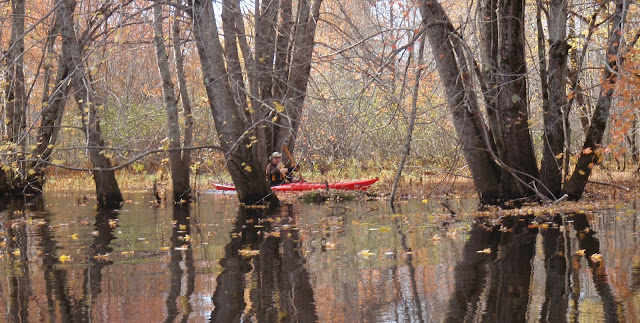
Recent rains have swelled our lakes and streams creating new pathways.  So who can resist leaving the stream bed to paddle amidst the trees?
Apparently not Mark and I.
Where am I?

Wednesday, September 12, 2012

Why We Went to Stockton Springs

 (I'm catching up on some earlier paddles - this paddle took place Aug 24; it makes sort of a nice followup to the Rockport to Camden series, because if that was our best paddle of the year, this is the tale of one of our worst paddles.)
    The launch in Stockton Springs enters into a big bowl, bounded on one side by Cape Jellison and the other by Sears Island.  As a result it is generally fairly quiet water.  Not generally what I'm looking for in salt water, but after a couple of terrible paddles on the Penobscot River , any other water would do.

   It started Monday morning, with a walk at the Bangor Waterfront.  As we strolled along, I noticed a grocery bag lying on the dock next to a boat.  The bag had a quart of milk in it, along with some other things, and appeared to have been forgotten by its owner.

    "We'll be seeing that in the river."  I remarked.

    Sure enough the next day, there it was bobbing along.  Knowing Mark hates the smell of spoiled milk, I got to it first, took the plastic container out, and holding it below the surface opened it.  This is our standard practice with any non-petroleum process.  Once rinsed I added the container to my back deck.  Then I reached in to see what else it contained.  Turned out it was spoiled meat and millions of nature's tiny recyclers.   

   While I was scrubbing those back into the water, Mark spoke up; "You're not just going to let that plastic drift to sea are you?"

     I wonder if Mrs. Trashpaddler ever threatens to dunk Al.  I would have considered it, but I need to make none of those little while maggots had crawled under my sleeves.  By the time I had finished, Mark had stepped up his game and pulled the plastic bag and tray out of the water.

     The next day was hot and sticky.  So much so that we only paddled a mile before turning back.  And there, in a spot we'd gone by not ten minutes earlier was a huge oil slick and at the center a five gallon pail with some unidentified gunk in it.  Once again Mark was the hero, balancing the pail and its contents on the back of his kayak, bringing it home and carrying the heavy bucket up the long hill.  Which is why, on Thursday, we went to Stockton Springs to take some lovely pictures at the low tide.  And those are the pictures displayed here.


Summary:  Launch: Stockton Springs Harbor, lots of parking, picnic tables, portapotties and a flush toilet with one of the prettiest views in Maine.  Chart of Stockton Springs can be found here.