How still was the air on Saturday? Still enough that it was easy to capture a seagull's reflection as it took flight.
How warm was it on Saturday? Warm enough that I didn't bother with waterproof boots, and waded through the water gladly.
Warm enough that folks in costume for the Zombie Walk and trick-or-treating wore only their costumes. When you live in Maine you get used to answering your door to find a princess skirt peaking out from beneath a warm winter coat and snow boots taking the place of glass slippers.
A very peaceful day to be on the water; at least here in Maine. We launched from Stockton Springs. The Harbor was busy- a lobsterboat bringing in traps and tossing them over the side.
A crew pulling the docks from the water.
The pending storm may have caused the work to be done on Saturday, but the season caused the dock to be pulled.
As we crossed to Sears Island remnants of morning fog were still visible.
But as a whole, what stands out was how quiet and still the ocean was, flat all the way to Isleboro.
Folks were out enjoying Sears Island, mostly walkers and their dogs. At times it seems like Sears Island is Maine's largest dog park. There were also hunters, dressed in bright orange. Saturday was the first day of hunting season and a great day to be out.
But on Sears Island, it seems like unwary dog walkers and hunters could be a bad mix. I've never heard of accidental shootings there, but next time I drive by I might add a sign that it's hunting season and tie an orange vest or two to the fence.
Sears Island is joined to the mainland by a causeway, so our adventure included a portage; two boats at a time up a trail, one boat at a time down the stairs.
Sears Island is also a great place to scout out sea birds. We saw scoters, laughing gulls, loons,herring gulls, mergansers, ring-bill gulls and cormorants.
Back in Stockton Springs the lobster boat had delivered a second load of traps. A dropping tide had left the first set of lobster traps above water, ready to be loaded on a trailer and moved off for winter storage.
A calm quiet day, which seems especially calm in view of the bigger, more exciting seas which are due. Hopefully all affected by Frankenstorm will take care and stay safe....
Summary: Launch Stockton Springs, lots of parking. Sadly the flush toilet is closed for the season, but a portapottie remains. 8 miles around Sears island, a portage required across uneven ground. High: 9:30AM. Launch 10:50 AM, finish 1:45PM; one stop, one portage.
Showing posts with label Stockton Springs. Show all posts
Sunday, October 28, 2012
Calm Before the Storm at Sears Island
Labels Penobscot, Maine, kayaking
Salt Water,
Sears Island,
Stockton Springs,
Trip report
Sunday, March 20, 2011
The Ruins of Stockton Springs
We haven't gotten out much this March. It seems like the few days I've had off are snowy, cold or include gale force winds. But we did manage a short jaunt (with drysuits and PFDs) last Sunday, along the shore of Cape Jellison from Stockton Springs Harbor. It was just a quick trip to Defense Point and back; a chance to delight in the salt air, try to reestablish a reasonable paddle stroke, and enjoy the calls of the long-tailed ducks.
We rescued our first dead balloon of the season.

And took a few pictures of the old pilings exposed by the ebb tide. These are the ruins marked on the chart below, stretching in front a long stream of condos, and easily visible from the landing at Stockton Springs.
As we paddled along, looking for just the right angle for a photo, I wondered, "What were these pilings, and why are there so many?"
Luckily, we live in an age where all questions can be answered. A search of Wikipedia provided this picture of the facilities when a long pier used to host schooners waiting to be filled with potatoes shipped by rail to the harbor.
The facility burned in 1924, though traces remain. More pictures of the harbor are available on the Wikipedia site.
We rescued our first dead balloon of the season.

And took a few pictures of the old pilings exposed by the ebb tide. These are the ruins marked on the chart below, stretching in front a long stream of condos, and easily visible from the landing at Stockton Springs.
As we paddled along, looking for just the right angle for a photo, I wondered, "What were these pilings, and why are there so many?"
Luckily, we live in an age where all questions can be answered. A search of Wikipedia provided this picture of the facilities when a long pier used to host schooners waiting to be filled with potatoes shipped by rail to the harbor.
![]() |
| Stockton Harbor 1906 |
Labels Penobscot, Maine, kayaking
Salt Water,
Stockton Springs,
Trip report
Friday, December 31, 2010
Stockton Springs - An Ideal Year End Paddle
![]() |
| Just one boat left in the harbor |
Basics: Plowed parking and access to ramp. No winter facilities. Low 1:38PN. Our paddle noon-1:30PM
At last Friday arrived and it was all we were promised; warmth, sunshine, low winds! We left our ice bound river and headed to Stockton Springs, launching from the beach to the distant chatter of eiders. We followed along the shore into the sun.
At the end of Cape Jellison is Defence Island, where a lone eagle guarded a nest.
From the island it was just a short distance to Buoy 4.
In the distance a large tanker and its tugs is making its way by Fort Point and into the mouth of the Penobscot River.
On Buoy 4 was a sticker. I guess our old friend Marcus Hanna has been tending to it.
We glided back on an incoming current, enjoying the visual feast of low tide in Maine; periwinkles, mussels, urchins, and long stretches of sand dollars. Here a periwinkle wends among the sand dollars.
As we were pulling out, lots of beach walkers were arriving. A truck pulled down the ramp, depositing this wonderful 65 pound rowing dory. We changed out of drysuits and into a more typical outer layer, and Mark chatted with the builder, who’s built several boats including a few kayaks.
![]() |
| What a beautiful boat! |
Tomorrow starts a whole new year! Best wishes to all!
![]() |
Labels Penobscot, Maine, kayaking
Stockton Springs
Friday, October 15, 2010
Stockton Springs to Fort Point (Maine)
Basics: Launch: Stockton Springs, restroom still open, portapottie still in place. Lots of parking. Launch 11:15, finish2:45 Low 10:45AM, 10.5 miles
There seem to be more and more challenges to paddling. Usually we like an early start. But 35 degrees? It seemed chill so we waited until it warmed up some, even though winds were expected to increase as Thursday went on. Winds from the southeast, which would be a 60 degree angle to most of our planned trip home. By ten, it was flirting with 50, so we headed out in our wet suits and waterproof boots to Stockton Springs.
The harbor was a busy place, a raft was moving about pulling up the moorings, owners were coming to pull their boats to shore. As we headed away we could see the Pentagoet, the Maine Maritime Academy tug, busy with a barge at the platform near Sears Island.
Stockton Springs' Harbor is basically a big bowl with a half mile wide opening between Sears Island and Cape Jellison, protecting it from many winds and waves. It’s not immune to wind and waves though, we’ve gotten there and changed our minds.
This photo shows the entry to the bowl bordered by Cape Jellison to the east and Sears Island to the west. In the distance, the island of Isleboro breaks up waves coming from the south.
The sun came out, the water was so still near Defence Point at the southernmost tip of the Cape.
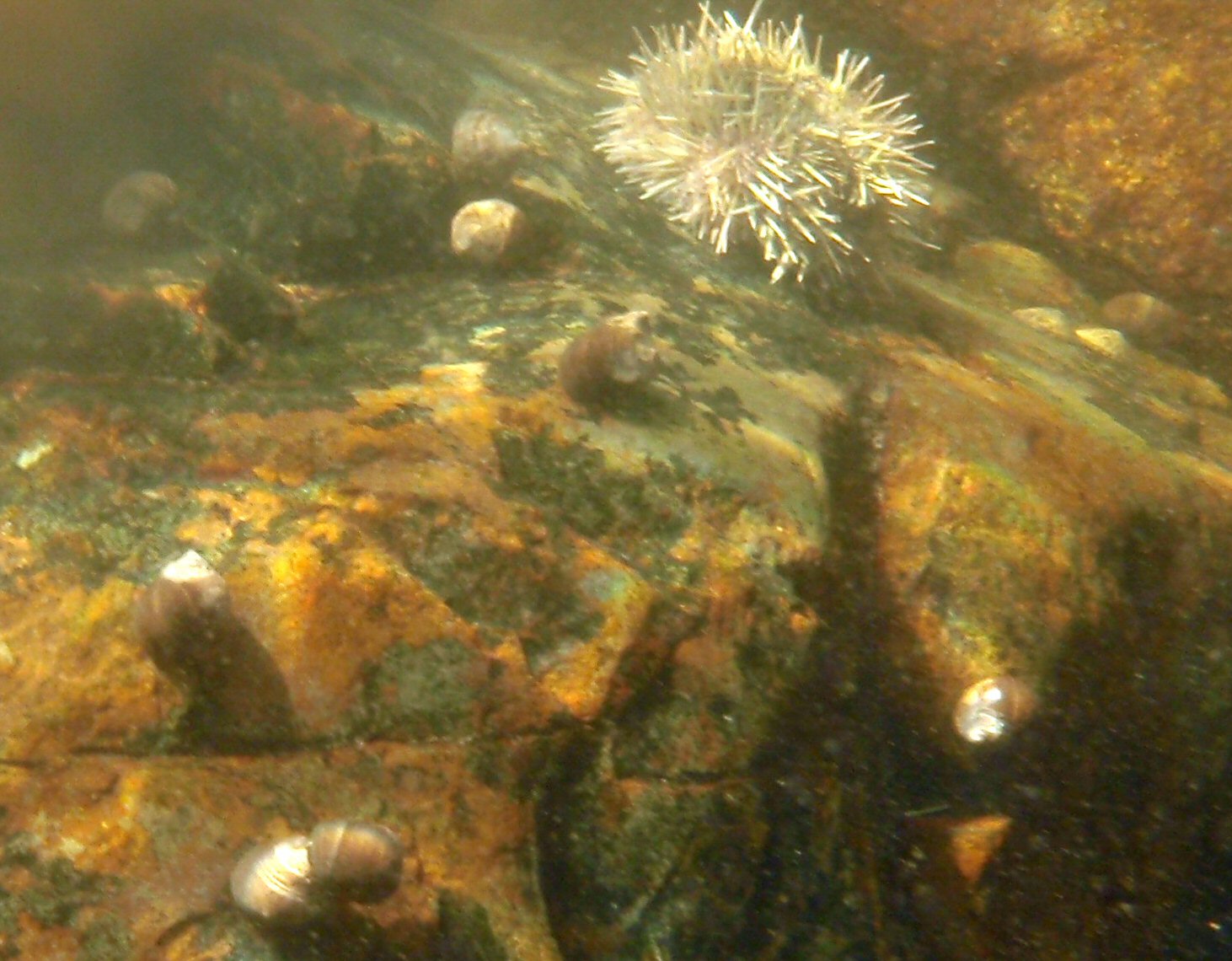
I love low tide on a still bright day, having an opportunity to see what on the sea floor. In the shallow depths some sea urchins and periwinkles remained.
Visibility was high, here Camden Hills peaks over Northport beyond the tip of Sears Island.
Defence Head, a tiny tidal island has a field of rocks at the end of it. It was still close enough to low that we needed to paddle an extra half mile around the island and its bar.
Because wind was expected later in the day, we debated whether to head to Fort Point, or whether to hang around in the harbor area. But we’d seen several boats heading in and out, as well as the student tugboat. We decided to keep to our plan, and headed off along the cliff studded south side.
Mark complained that he had to struggle to keep up with me. At first I thought it was just because I was in the Vaag, but as I thought about it, I’d been in the Vaag on a couple of paddles recently, and neither time had Mark mentioned trouble staying ahead. Once we’d even switched boats, so I knew on flat water they both went about as fast. Still, plainly the Vaag caught the wind better than the Zephyr. That didn’t bode well for the return trip.
Soon enough the Fort Point lighthouse came into site.
We moved into the mouth of the Penobscot River, with the Penobscot Narrows Bridge distantly in sight, and pulled over to the sandy bar. Not a beach, swimming is not allowed due to dangerous currents, especially on an outgoing tide.
Right off the bar was a birch tree with no less than 4 woodpeckers jumping about the branches. I didn’t know what they were eating, not wanting to get close enough to disturb them.
Fort Point is a state park and historic site, with a picnic area, pit toilets and foundations of two forts available for a low entry fee. It is just a short drive from the launch point. We ate our lunch and wandered about, joining other photographers taking pictures of the area, and watching the wind build.
The wind never was too bad, but there was wind and chop on the way back, which regularly slopped over the deck or up my left arm. I was pleasantly surprised to find the ocean was still quite warm. It never got above 60 on the trip, but I didn’t need gloves. I used a low short stroke heading back. The wave angle was such that I didn’t need to make many correcting strokes. This time, Mark had no complaint about keeping up, instead I fell behind. Partly that may have been the effect of wind on the Vaag, but I’m sure it was also that wind makes me more cautious. Still we made good time, much better time than getting to Fort Point, mainly because it was too choppy to waste time on photos.
The water was high enough to make Defence Head once again an island, and to allow us safe passage closer to shore without hitting any rocks.
Once between Sears Island and Stockton Springs we made even better time. The waves were less, but the wind and incoming tide pushed us along, and the chop was significant enough that we paddled quickly to keep our boats under control.
The Pentagoet was still towing the barge about and docking at the platform. The mooring pulling was still in process, as was the boat removal.
I was grateful that the restroom with the nicest view of any boat launch was still open so I could change into dry clothes for the trip home.
Time from launch to Fort Point: 11:15AM-1PM. Time to return to Stockton Springs: 1:30PM to 2:45PM. We’ve gotten used to picking the best day of the week for ocean going trips; best being defined as warm, clear and low winds. So it was nice to be reminded that less than perfect conditions are still fun.
There seem to be more and more challenges to paddling. Usually we like an early start. But 35 degrees? It seemed chill so we waited until it warmed up some, even though winds were expected to increase as Thursday went on. Winds from the southeast, which would be a 60 degree angle to most of our planned trip home. By ten, it was flirting with 50, so we headed out in our wet suits and waterproof boots to Stockton Springs.
The harbor was a busy place, a raft was moving about pulling up the moorings, owners were coming to pull their boats to shore. As we headed away we could see the Pentagoet, the Maine Maritime Academy tug, busy with a barge at the platform near Sears Island.
Stockton Springs' Harbor is basically a big bowl with a half mile wide opening between Sears Island and Cape Jellison, protecting it from many winds and waves. It’s not immune to wind and waves though, we’ve gotten there and changed our minds.
This photo shows the entry to the bowl bordered by Cape Jellison to the east and Sears Island to the west. In the distance, the island of Isleboro breaks up waves coming from the south.
![]() |
![]() |
| Defence Head, low tide |
Visibility was high, here Camden Hills peaks over Northport beyond the tip of Sears Island.
Defence Head, a tiny tidal island has a field of rocks at the end of it. It was still close enough to low that we needed to paddle an extra half mile around the island and its bar.
Because wind was expected later in the day, we debated whether to head to Fort Point, or whether to hang around in the harbor area. But we’d seen several boats heading in and out, as well as the student tugboat. We decided to keep to our plan, and headed off along the cliff studded south side.
Mark complained that he had to struggle to keep up with me. At first I thought it was just because I was in the Vaag, but as I thought about it, I’d been in the Vaag on a couple of paddles recently, and neither time had Mark mentioned trouble staying ahead. Once we’d even switched boats, so I knew on flat water they both went about as fast. Still, plainly the Vaag caught the wind better than the Zephyr. That didn’t bode well for the return trip.
Soon enough the Fort Point lighthouse came into site.
We moved into the mouth of the Penobscot River, with the Penobscot Narrows Bridge distantly in sight, and pulled over to the sandy bar. Not a beach, swimming is not allowed due to dangerous currents, especially on an outgoing tide.
Right off the bar was a birch tree with no less than 4 woodpeckers jumping about the branches. I didn’t know what they were eating, not wanting to get close enough to disturb them.
Fort Point is a state park and historic site, with a picnic area, pit toilets and foundations of two forts available for a low entry fee. It is just a short drive from the launch point. We ate our lunch and wandered about, joining other photographers taking pictures of the area, and watching the wind build.
![]() |
| The Bell Tower at Fort Point |
The wind never was too bad, but there was wind and chop on the way back, which regularly slopped over the deck or up my left arm. I was pleasantly surprised to find the ocean was still quite warm. It never got above 60 on the trip, but I didn’t need gloves. I used a low short stroke heading back. The wave angle was such that I didn’t need to make many correcting strokes. This time, Mark had no complaint about keeping up, instead I fell behind. Partly that may have been the effect of wind on the Vaag, but I’m sure it was also that wind makes me more cautious. Still we made good time, much better time than getting to Fort Point, mainly because it was too choppy to waste time on photos.
The water was high enough to make Defence Head once again an island, and to allow us safe passage closer to shore without hitting any rocks.
Once between Sears Island and Stockton Springs we made even better time. The waves were less, but the wind and incoming tide pushed us along, and the chop was significant enough that we paddled quickly to keep our boats under control.
The Pentagoet was still towing the barge about and docking at the platform. The mooring pulling was still in process, as was the boat removal.
I was grateful that the restroom with the nicest view of any boat launch was still open so I could change into dry clothes for the trip home.
Time from launch to Fort Point: 11:15AM-1PM. Time to return to Stockton Springs: 1:30PM to 2:45PM. We’ve gotten used to picking the best day of the week for ocean going trips; best being defined as warm, clear and low winds. So it was nice to be reminded that less than perfect conditions are still fun.
Labels Penobscot, Maine, kayaking
Fort Point,
lighthouse,
Salt Water,
Stockton Springs,
Trip report
Wednesday, August 11, 2010
Stockton Springs to Sears Island ME – Bunch o'birds

Basics: Launch Stockton Springs: Easily parking for twenty SUVs with trailers, another thirty cars. Portapottie, inside flush toilet with a nice view of the harbor, picnic tables, grills, playground. Launch about 8:45AM, finish about noon. 8 miles. High 12:08. More about the harbor.
The boat launch at Stockton Springs is charming and delightful. The town has put a lot of work into the facilities; upgrading the dock, adding moorings, putting in benches, tables and a playground, adding the wonderful bathroom. It’s usually a very quiet launch site. The launch leads to a protected area, the town to the north, Cape Jellison along the east and Sears Island to the west. It’s not ideal for all weather, but it is usually less challenging than other locations.
We often launch here to catch low tide, the bottom here is sandy offering a home to sand dollars and other creatures. If we land at the erratic on Sears Island which in line with the green can we can often find sand dollar husks, but only at the lowest tides.

Today low tide came too early, we launched mid tide. And with a wind from the north we knew we’d make quick time along Cape Jellison.
We cruised out by the pilings, custom made to display cormorants,

and along the wonderful beach down to the tiny island at the end, often a nesting site for osprey and or eagles. In addition to Gulls and Cormorants, birds we spotted on our way south were terns, loons and a few guillemots in the muted gray feathering of the young. Then it was across to Sears Island. Sears Island is the largest unpopulated island off the Maine coast. I love it as a paddling and hiking destination, but the state wants to preserve its right to put a dock facility in. Enjoy the freedom of Sears Island while you can.
You can hike around Sears Island when the tide is low, as it comes in there are a couple of spots, one here by the iron outcropping, another not far from the causeway to the west which fill up and become impassible.

We paddled north along Sears Island, taking time to check out the nests on the loading dock. Next it was over to the GAC facility, and the cormorants there.

In the background you can see the causeway to Sears Island, always a popular locations for birders, hikers, and dog walkers.
On the way across the cove we passed through a gathering of laughing gulls, mature and immature. Lively birds, their antics in flight would entertain us all along the north shore.


We heard eiders in the distance and could see a small raft of eiders heading to the center. Closer to shore a common merganser and her brood of over a dozen swam along. Then there was this bird; a yellow legs? A upland sandpiper? (We can't claim to be experts, or even good, at bird identification.)

In the northeast corner a couple lobster boats were drawn up on shore. They seemed to have been recently painted, but mostly were fading into landscape.
We went under the West Cape Rd Bridge into a back bay.

(taken from in the back bay, looking back to open water)
It’s always a little bit foolish to do things like that; the current which takes you under the bridge may prevent you from coming out, or the water may rise too high to allow safe exit.

But near high, we didn’t have much trouble and we found a pretty little area with lots of crows, but no shore birds.
Then it was back to the launch, in time to see groups arriving to enjoy the lunch facilities.

Route

Labels Penobscot, Maine, kayaking
laughing gull,
Osprey,
Salt Water,
Sears Island,
Stockton Springs,
Trip report
Subscribe to:
Posts (Atom)