Showing posts with label Naskeag Point. Show all posts

Thursday, July 30, 2015

Racing low at Naskeag (Maine)

Looking from Pond Island to Blue Hill Bay Light on Green Island

  As I sit in the basement, trying to get my brain to think on this hot, sticky day, it's hard to remember how cold it was last Saturday.  61 degrees (F)  with a light but steady wind from the east and iffy skies.  So of course we headed to Naskeag, a launch site from which we regularly get caught in fog or rain.

   But we go to Naskeag for multiple reasons; you can get to islands without crossing any channels,  it's easy to get to and rarely crowded,  and most importantly, there are so many wonderful places to go if it is clear enough

  There is plenty of parking for cars at Naskeag Point in Brooklin Maine, but less for vehicles towing trailers.  Some trailers parked on the beach (a firm crushed granite beach), some along side of the road, a few placed a trailer in one spot, truck in the other and one took up four or five spaces.

  Though the skies were gray, there was no fog, so we headed across to Pond Island, passing on the way Mahoney, a active bird island.  In addition to the variety showing up in the picture (cormorant, gulls, eiders) terns, guillemots, and loons hung out by the island.


  Our crossing took us to Opechee, then it was a matter of seeing if we could beat low to cross between Opechee and Jons, and again between Opechee and Black.  The water was just passable between Opechee and Black.

   Over 100 seals were spotted on various ledges.  This shot is of a crowded ledge east of John's Island.


   Only one raccoon was scene, running free on Opechee.


   Lunch, at just about low, was on Pond Island, before riding some choppy water back to Naskeag.

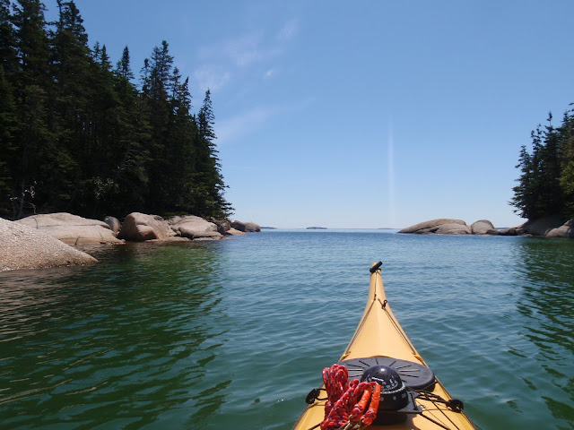
Another picture from Pond Island

  Summary:  Launch 10:30AM, low just about noon, finish about 1:30.  8 miles, one break.   Naskeag offers about 20 single car spaces, trailered vehicles tend to part on the side of the road.  Port-a-pottie.   All tides crushed rock ramp, dock, also a nice picnic area and beach at the launch.

Tuesday, July 30, 2013

Smart Enough to Come in? I guess not...

Naskeag Harbor launch
 I suppose it's no coincidence that we often wind up at Naskeag on foggy mornings.  After all, there are so many islands close to shore.

Erratic by Babson
    And the fog was supposed to lift.  Besides, there's an erratic to amuse us.
 Fog is a chance to test navigational skills.  We haven't headed west recently from Naskeag Point, Mark is trying to figure out which island that odd monument is located on.
Lone Tree Monument of Torry Islands
A bit further along and it's apparent the monument is really a tree; the lone tree monument (by the sailboat.)

Mark by Bear Island, most of his shirt is still dry
Fortunately the fog was light enough to cross the channel.  Further on the rain started.   Well, showers were predicted for afternoon.  We though the rain would  stop soon.

Cormorants on the Boulders
Or not.

Eventually, it seemed prudent to head back.  Our final debate was if we should stop on an island  first?  Our seats were about the only dry part left.  And, we'd certainly get wet loading our boats back onto the car.
Hanging out on Sellers
It may be damp, but it's still our own special island!
Coming into the harbor, we finally saw Blue Sky!

Summary:  Launch Naskeag Point, Brooklin Maine.  Busy work launch, easiest to park on Sundays.   If you go on a threatening Sunday, you can be the only car in the lot!   Portapottie, gravel launch.   Launch 10AM, finish 1 PM, high about 4:15PM, one break.  9 miles.

Friday, July 20, 2012

One Misty, Moisty Morning in Maine, off Naskeag Point


    Fog happens, even on the best of waters.  And when it does it provides a great opportunity to practice navigation.    There’s something quite satisfying about calculating an angle from the chart, estimating a time of arrival, heading off into the great white nothing and having land appear as predicted. 

   Much of the time, since we use charts printed with magnetic north lines on them, I can do a rough estimate of the angle required just by glancing at the chart, and verify by sighting the island.  But in a cocoon of white, precise measurements count. 

  We were practicing in Herrick Bay, between Naskeag Pt and Flye Pt; a small bay whose silence told us there were no lobster boats in the area.  And we were quite pleased with ourselves until we came upon this speck of land off Flye Point.   
    On our charts we read it to be an unnamed lump by 17, right off the point.  Flye, Gander and Goose Islands, 1/4 to 5/8 miles away were out of sight. 

     “150 to Gander,”  I announced and Mark agreed.  But just a short ways out, as land appeared, it was apparent we were off.  Charts were double checked, and excuses made.  My most common excuse is that over short distances just a slight misreading, from the edge of the island, instead of the center, makes a big difference.  But Mark was not happy, not until he made it home and checked Google Earth, when he could report, with satisfaction, that our charts were in error.
   Fog can have other magical moments;  just after launching from Naskeag Point a pod of six (or so) porpoises entered in.  In the quiet waters their distinctive “puffs” on surfacing made it easy to track them.  I sat there in the silence enjoying their presence.
   Not that fog is entirely wonderful.   Lobster boats were out, making crossing Eggemoggin Reach and Jericho Bay unappealing.   At 66F and 100% humidity, it was a clammy paddle.  And when a slight drizzle became a steady downpour we decided to cut our trip short. 

   A short while later, as we approached Naskeag Pt the rain lightened, so we continued on to a few more islands and lunch on Sellers.   
    The rain lifting was one example of the “don’t like the weather – wait five minutes” rule; which also came into play when we decided to check out Haven.  Haven is the mythical Maine location for a Steven King based television series formerly on the SyFy channel; worth watching for the beautiful coastal scenery alone.  Unfortunately, it’s filmed in southeast Nova Scotia, not Maine.  But on our charts, Haven was shown a mile west of Brooklin.  We drove through Haven hoping to find a church or grange with a “Haven sign” enshrouded in fog.  Sadly we didn’t spot any Haven signs, only a few large houses, and no fog.  The fog had temporarily lifted.  Google would later confirm that Haven was just an enclave of summer houses.

Tuesday, July 3, 2012

Naskeag Pt to Orono Island - Brooklin Maine

      Sometimes it seems like so long since I've had lunch on an island.  Sat on it's granite shore while noshing on cheese puffs, cheese sticks and carrots.  So when I realized we had nothing scheduled for Sunday, I guarded that day like a pit bull, casting chores and invitations aside and headed to the ocean.

      By 9:20AM we were ready to paddle, launching just behind another couple and headed in the same direction.  Past Smuttynose and Mahoney Ledge before crossing the lobster buoy gardens of Jericho Bay to Opechee. 
   
    From Opechee and Swans Island are many ledges, many seals, more than a couple over-nighting sailboats, two narrow boat channels and at least one picture perfect pocket sized island.
     The shallow waters created bands of turquoise, which alternated with the dark blue.  
     Between the islands laughing gulls practiced their balancing acts. 
     We didn't quite make Swans Island, but instead looped about privately owned Orono Island.  Orono Island, named for Joseph Orono the blue eyed Penobscot Sachem thought to be a grandson of Baron Castine, is a lovely park-like island, surrounded by a huge school of small fish.  All along the shore the fish surrounded us, racing in various directions and, in their haste to flee, occaisionally pushed their schoolmates atop seaweed.  
  From there we paddled about Black Island, alongside Sheep and Pond.  Near Pond, after not seeing any seals for several minutes, a pup popped up beside my boat and stared at me with wide innocent eyes.  I explained to the pup that he should be terrified of kayaks, but he did not listen, popping up a few more times as we moved on.
    I thought we'd stay out all day, but by noon-thirty I'd had more than enough sun, so we headed back to Naskeag, landing shortly after 1PM.   I backed carefully, and a little regretfully, into this view to leave.  
   (Thanks to Durhamblogger for the rear view mirror idea)
   That was Sunday.  Now it's Tuesday, and it seems like so long since I've had lunch on an island....

   Summary:  Launch Naskeag Point, Brooklin.  Busy work launch, easiest to park on Sundays.  Portapottie, gravel launch.   Launch 9:20, about an hour after high, finish 1:15, one break.  11.3 miles.  We did get a chance to go to shore for a pleasant lunch on a MITA island.
Monday, August 8, 2011

Naskeag Point, Brooklin Maine

Basics: Best for a Sunday, Launch on Naskeag Point Rd in Brooklin, about 35 parking spaces and one portapottie. Launch 10:30AM, finish 2:30PM 8 miles and a long stop. Potato Island completely loses its beach at high tide.

Yes, there is a Brooklin Maine; it’s a tiny coastal community which bills itself as the boat building capital of the world, a distinction earned mainly through the efforts of the Wooden Boat School. Driving to Naskeag Point takes you right by the Wooden Boat campus, and the launch is impressive right from first sighting, a lovely spit of salmon colored granite gravel edging into green waters filled with lobster boats, a cottage-filled island just off shore.

Across from the parking lot, and just inland from the dock is an apple tree speckled picnic area. A granite marker reads “Battle of Naskeag, reenacted 1976” making it unclear if the park honors the battle of 1778, or the reenactment. link There is also a tribute to fishermen, and a memorial to fisherman.
The launch gravel is compacted well enough for trailers near the dock, but becomes looser further out. This is another harbor used heavily by commercial fisherman. When we’ve been there during the week it’s generally pretty packed. But on Sunday morning, when we arrived just after 10AM, the lot was nearly empty.
Less than half a mile off Naskeag Harbor, tucked behind privately owned Harbor Island is the adorable Seller Island, owned by the Maine Bureau of Public Lands. Camping is allowed there, and it is probably occupied every weekend all summer.

One of the challenges of Naskeag is that there are two busy throughfares nearby, if you head east to Pond Island, you will be crossing into the traffic coming in and out of Blue Hill Bay, if you continue south you’ll cross Eggemoggin Reach, a busy throughfare as well.


Can marking Eggemoggin Reach, Isle au Haut in the distance

We paddled south, crossing Eggemogin Reach near its buoys and continuing on to loop about the Lazygut Islands. There’s something irresistible about paddling in a narrow channel between two islands.


By Stinson Neck


Between the Lazy Guts
Then we headed back to Potato Island for lunch. Like Sellers, Potato is a Maine Bureau of Public Lands Island, but being further out, it sees less use. Sellers and Potato are both islands which demonstrate bigger isn’t always better. Both are small, surrounded by ledge and loose boulders, so that if you are nimble and willing to scramble a bit, you can quickly circumnavigate either island on foot touching only rock surfaces.

Potato has a beautiful shell beach connecting it to ledge, which unfortunately, near high tide was completely underwater. Instead we landed in seaweed and tied our kayaks to rocks.


The white beach is visible, but not available
These are a few shots taken on Potato.


The area has a reasonable number of seals, we spotted a few at a distance. There's also an assortment of seabirds.

In addition to Maine Bureau of Public Land islands, a few privately owned islands in the area allow access by Maine Island Trail Association .
Heading back in was more of a challenge. Not too surprisingly Eggemoggin Reach was busier than when we’d headed out. We waited for a few sailboats to pass, then angled so as to cross behind this red-sailed boat.

A different party was on Sellers when we went by, this time two very serious looking paddlers with enough gear on their decks to imply they were doing a long section of trail.
And, also not too surprisingly, the launch was busier as well, with skiffs ferrying adventurers and their gear in from weekend adventures in their island cottages, and Sunday afternoon paddlers heading out. All in all another wonderful day on the Maine coast.


You can see a portion of Lazygut at the bottom left