Basics: Launch: Stockton Springs, restroom still open, portapottie still in place. Lots of parking. Launch 11:15, finish2:45 Low 10:45AM, 10.5 miles
There seem to be more and more challenges to paddling. Usually we like an early start. But 35 degrees? It seemed chill so we waited until it warmed up some, even though winds were expected to increase as Thursday went on. Winds from the southeast, which would be a 60 degree angle to most of our planned trip home. By ten, it was flirting with 50, so we headed out in our wet suits and waterproof boots to Stockton Springs.
The harbor was a busy place, a raft was moving about pulling up the moorings, owners were coming to pull their boats to shore. As we headed away we could see the Pentagoet, the Maine Maritime Academy tug, busy with a barge at the platform near Sears Island.
Stockton Springs' Harbor is basically a big bowl with a half mile wide opening between Sears Island and Cape Jellison, protecting it from many winds and waves. It’s not immune to wind and waves though, we’ve gotten there and changed our minds.
This photo shows the entry to the bowl bordered by Cape Jellison to the east and Sears Island to the west. In the distance, the island of Isleboro breaks up waves coming from the south.
The sun came out, the water was so still near Defence Point at the southernmost tip of the Cape.
 |
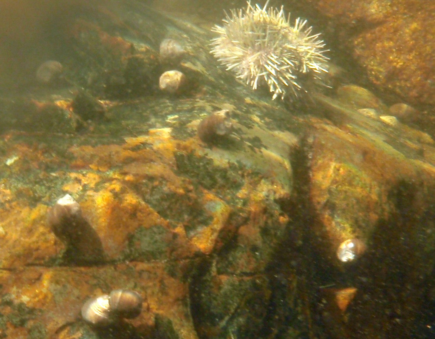
| Defence Head, low tide |
I love low tide on a still bright day, having an opportunity to see what on the sea floor. In the shallow depths some sea urchins and periwinkles remained.
Visibility was high, here Camden Hills peaks over Northport beyond the tip of Sears Island.
Defence Head, a tiny tidal island has a field of rocks at the end of it. It was still close enough to low that we needed to paddle an extra half mile around the island and its bar.
Because wind was expected later in the day, we debated whether to head to Fort Point, or whether to hang around in the harbor area. But we’d seen several boats heading in and out, as well as the student tugboat. We decided to keep to our plan, and headed off along the cliff studded south side.
Mark complained that he had to struggle to keep up with me. At first I thought it was just because I was in the Vaag, but as I thought about it, I’d been in the Vaag on a couple of paddles recently, and neither time had Mark mentioned trouble staying ahead. Once we’d even switched boats, so I knew on flat water they both went about as fast. Still, plainly the Vaag caught the wind better than the Zephyr. That didn’t bode well for the return trip.
Soon enough the Fort Point lighthouse came into site.
We moved into the mouth of the Penobscot River, with the Penobscot Narrows Bridge distantly in sight, and pulled over to the sandy bar. Not a beach, swimming is not allowed due to dangerous currents, especially on an outgoing tide.
Right off the bar was a birch tree with no less than 4 woodpeckers jumping about the branches. I didn’t know what they were eating, not wanting to get close enough to disturb them.
Fort Point is a state park and historic site, with a picnic area, pit toilets and foundations of two forts available for a low entry fee. It is just a short drive from the launch point. We ate our lunch and wandered about, joining other photographers taking pictures of the area, and watching the wind build.
 |
| The Bell Tower at Fort Point |
The wind never was too bad, but there was wind and chop on the way back, which regularly slopped over the deck or up my left arm. I was pleasantly surprised to find the ocean was still quite warm. It never got above 60 on the trip, but I didn’t need gloves. I used a low short stroke heading back. The wave angle was such that I didn’t need to make many correcting strokes. This time, Mark had no complaint about keeping up, instead I fell behind. Partly that may have been the effect of wind on the Vaag, but I’m sure it was also that wind makes me more cautious. Still we made good time, much better time than getting to Fort Point, mainly because it was too choppy to waste time on photos.
The water was high enough to make Defence Head once again an island, and to allow us safe passage closer to shore without hitting any rocks.
Once between Sears Island and Stockton Springs we made even better time. The waves were less, but the wind and incoming tide pushed us along, and the chop was significant enough that we paddled quickly to keep our boats under control.
The Pentagoet was still towing the barge about and docking at the platform. The mooring pulling was still in process, as was the boat removal.
I was grateful that the restroom with the nicest view of any boat launch was still open so I could change into dry clothes for the trip home.
Time from launch to Fort Point: 11:15AM-1PM. Time to return to Stockton Springs: 1:30PM to 2:45PM. We’ve gotten used to picking the best day of the week for ocean going trips; best being defined as warm, clear and low winds. So it was nice to be reminded that less than perfect conditions are still fun.