Showing posts with label Porcupine Islands. Show all posts
Monday, September 29, 2014
Porcupine Islands in late September
80 degree(F) days in late September! Who can resist being outside? Not me!
Sunday we were up early and off to Bar Harbor to launch from the bar. At 8:30 there were some walkers, and a few cars out testing the make-shift road exposed by the tide.
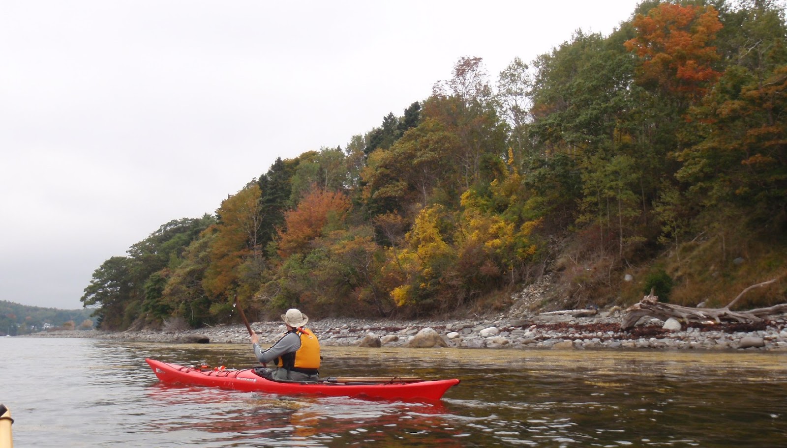
It was a still day, perfect for exploring - and the photos say it is definitely fall.
Just one cruise ship in the harbor, but my eyes kept being drawn to it. Cruise ships dominate the waters off Bar Harbor in the fall. A few lobster boats were out working, as were various tour boats.
All alone at the Hop, except for this armada of loons.
Not many urchin casts on the beach, usually in fall there are several. This is a picture of the only one I saw. Instead, there was a fair amount of trash, enough to fill a grocery bag, with an extra bottle or two to spare.
Not many other kayaks out; two tour groups by the first two porcupine islands (Bar and Sheep) and this paddleboarder way out by Long Porcupine.
I felt very lucky to have been able to take advantage of the warmth; that so few others were at the Porcupines with us I can ascribe only to the multitudinous choices of outdoor activities in Maine.
Summary Information: Launch Bar at the end of Bridge Street in Bar Harbor. No parking at launch: parking is available on West Street and side streets. No facilities: the information booth on Thompson Island is one options as are public toilets at the town dock.
High about 2:30 PM Launch 8:45AM Finish 12:30PM. 8.8 miles one stop.
Labels Penobscot, Maine, kayaking
Mount Desert Island,
Porcupine Islands,
Salt Water,
Trip report
Friday, October 4, 2013
A Sighting of Ctenophora
![]() |
| At least four little creatures are in this picture |
A little ways on, there were more, and then a few of these larger creatures:
My Mac's Field Guide to Northeast Coastal Invertebrates identified the larger creatures as Northern Comb Jellies and the superball-sized ones as Sea Gooseberries. Some more research at home would provide some interesting tidbits.
Both Northern Comb Jellies and Sea Gooseberries are Ctenophora. (Americans get to use CB language to pronounce Ctenophora, "10-o 4-a little rainbow buddy," but everyone else has to append a "ka" on the front.) Ctenophora are a separate phylum from jellyfish, (which are cnidarians). Both ctenophora and cnidarians are simple brainless creatures. Both are a mass of jelly with cell layers outside and lining the body cavity. In the ctenophora those layers are two cells thick (versus one for the jellyfish.)
| An underwater shot |
![]() |
| This is blurry but is shows a few flashes of green and blue |
These little creatures look harmless, but Ctenophora are voracious carnivores; consuming zooplankton, fish eggs and pretty much anything else they can stuff inside themselves. They can eat ten times their body weight every day.
One species of ctenophora, the sea walnut or Mnemiopsis, is an invasive species in the Black Sea, destroying the fishing industry there.
Blooms of ctenophora, like jellyfish blooms, can be a sign of an ecosystem out of whack, or they might just indicate favorable conditions for breeding. Ctenophora reproduce year 'round.
There are about 150 known species of ctenophora, found from arctic to tropic waters. Many are bioluminescent.
So, those were our new species sighting of the day! If you'd like to learn more, check out:
Wikipedia: Centaphora http://en.wikipedia.org/wiki/Ctenophora
Centophores - some notes from an expert - http://faculty.washington.edu/cemills/Ctenophores.html
Smithsonian Jelly Fish and Comb Jellies - http://ocean.si.edu/jellyfish-and-comb-jellies
![]() |
| Mark is moving on... |
Labels Penobscot, Maine, kayaking
Bar Harbor,
General Kayaking,
Porcupine Islands,
Sea Combs
Tuesday, June 18, 2013
Scenes from the Porcupines - Mount Desert Island
![]() |
| Out by Burnt Porcupine and Rum Key looking across Frenchman's bay |
We were greeted by a black backed gull and a porpoise at buoy 7. We'd see another pod of porpoise out beyond Long Porcupine.
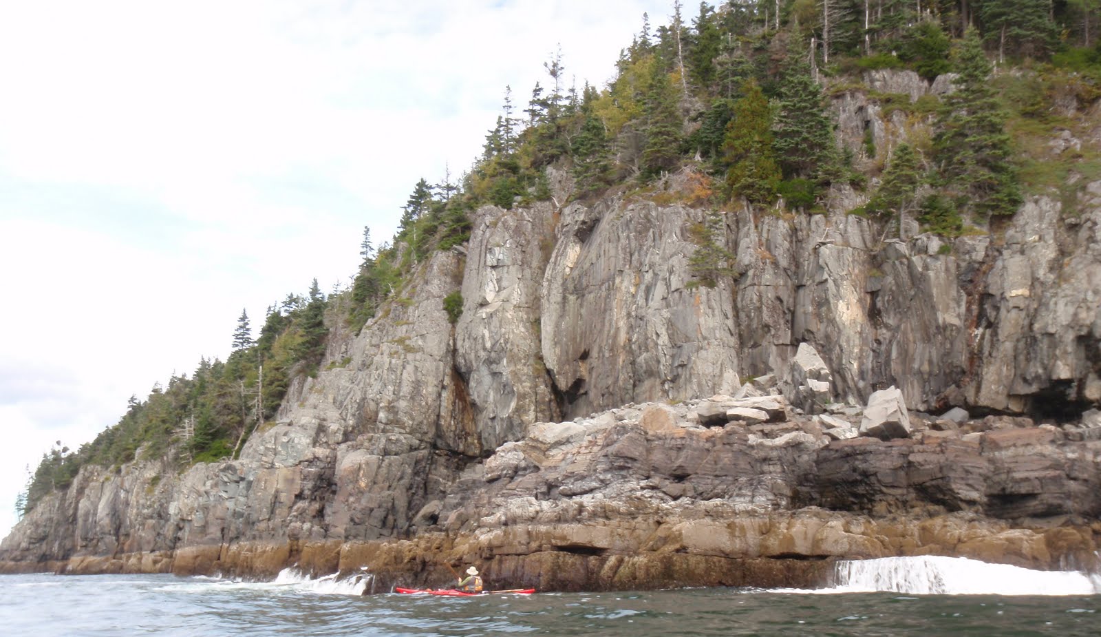
The cliffs, as always were amazing.
Lots of guillemots on the water, once again, most came out in pictures as blurry black dots. We took a break on the tombolo between Long Porcupine and the Hop.
Out at the Hop lots of new sea bricks had been deposited on shore. Bricks (or stones) were a necessity to sink wooden lobster traps, at least until the laths became soaked. With metal traps, bricks help keep the trap in place, and help it to sink right side up. These bricks have escaped from traps and tumbled across the ocean floor before being tossed up on shore. (Many traps now use concrete bars instead - somewhat less attractive.)
Lots of others out on Frenchman's Bay. We came upon the Margaret Todd by Rum Key. I just love this four masted schooner, so I had a hard time choosing between this shot of the ship on Frenchmen's Bay.
This one, sailing by Sheep Porcupine with Cadillac Mountain in the background.
Or this with Mark positioned between them.
At any rate, there are few places as magnificent for paddling.
Summary Information: Launch Bar at the end of Bridge Street in Bar Harbor. No parking at launch: parking is available on West Street and side streets. No facilities: the information booth on Thompson Island is one options as are public toilets at the town dock.
High about 5:30 AM Launch 9AM Finish Noon. 8 miles
Labels Penobscot, Maine, kayaking
Bar Harbor,
Porcupine Islands,
Salt Water,
Trip report
Monday, October 8, 2012
Seven Reasons to visit the Porcupines
![]() |
| Two boats on The Hop |
2. If it's moderate water, it makes a wonderful paddle; if it's still water we'll explore the keyholes. (If it's big water, we'll paddle elsewhere.)
3. It's already Fall. Mark has begun his annual petition to move south for the winter. Our skirts and PFD's come inside to dry. Our water shoes linger on the porch, perpetually damp and cold. Post dinner paddles? Only if we're committed to paddling in the dark. Days suitable for ocean adventures grow farther apart and our selections seem more important. This might be the last day in 2012 where our availability and weather allow a trip to the Porcupine Islands. Can driving a long distance to test a new harbor compete with a known quantity a little over an hour away?
4. A wonderful bell buoy.
5. A quiet beach to explore. To the east side of Long Porcupine waves roll in from the south, to the west they are blocked and the water calm. As a result of the active water/quiet water dichotomy; the west sides of islands tend to have gentle slopes and beaches, the east side soaring cliffs and ragged edges. We usually aim for the Hop and its wonderful beach.
![]() |
| Water patterns at the Hop |
7. Check on the color.
![]() |
| Nowhere near peak color. In fact the day was mostly a palette of green and gray. |
Now that the season is winding down, I hope you're able to get out to some of your favorite paddling places!
Prior visits: Bar Harbor to the Hop
Porcupine Islands - Always Amazing
Porcupine Islands with Ironbound
Summary Information: Launch Bar at the end of Bridge Street in Bar Harbor. No parking at launch: parking is available on West Street and side streets. No facilities: the information booth on Thompson Island is open through October; public toilets are also available at the town dock, seasonally.
High 2:45PM Launch 10:30AM Finish 1:30PM.
Labels Penobscot, Maine, kayaking
Porcupine Islands,
Salt Water,
Trip report
Thursday, July 28, 2011
Porcupine Islands Again
Basics: Launch Bar at the end of Bridge Street in Bar Harbor. No parking: parking is available on West Street and side streets. No facilities: the information booth on Thompson Island has toilets, as does the town dock. High 8.22AM Launch 9:00AM Finish 1:30 PM, 12 miles.
The Porcupines again? Why not, not only are the Porcupines only an hour away, but I think the Porcupine Islands are one of the best sea kayak trips Maine has to offer. They have dramatic cliffs, water which feels like open ocean instead of a pond, salt air smell and most important, a backdrop of mountains, lobster boats and sailboats. And, as is probably no coincidence, Bar Harbor offers many guided kayak tours out to the Porcupines. Most of the group trips won’t make it out as far as Long Porcupine, much less Ironbound, but there are plenty of great sites on the inner islands as well.
Much of the area between Bar Island and Mount Desert Island (MDI- the island with Bar Harbor and other towns on it) drains out by low tide, we took advantage of the high tide to cross over that land, passing by a different set of tandems, this nicely grouped set one which had probably launched from the Town Docks.
We stopped at the Hop to free what must have been a suicidal attack periwinkle from Mark’s skeg box. The tombolo between Long Porcupine and the Hop was completely underwater, and the beach pretty small.
We wandered the beach, gathering some drifted trash and taking a few close-ups.
Then it was off to Ironbound. A few of the inlets seemed tame enough to peek into. A few cautions to consider should you consider doing the same: think ahead of time about rescue options should anything go wrong; having a throw rope ready might be a good idea. Watch the opening through the duration of a few swells to see the pattern inside. Keep someone outside to watch for passing boats (and their wake) or a change in the wave pattern. I’ve heard that you should back into caves, since it allows you to keep a good watch on incoming swells, keeps you cautious and makes it easier to get out.
On the way back we stopped at Rum Key for a snack (having promised ourselves Geddy’s Pizza for lunch.) No surprise, before we left another kayak tour landed for their break. You can see them there in the top photo. And what a beautiful place for a snack!
At the channel between Burnt and Sheep Porcupine several harbor porpoise were feeding. A few surfaced right beside Mark, but were gone by the time a camera was out.
Coming back to the Bar, especially now that it was fully exposed, was an exercise in contrasts. We’d been by ourselves at the Hop, seen no other kayaks beyond Rum Key, but on shore we were in the midst of explorers speaking a polyglot of languages. I think it’s wonderful to see so many people outside enjoying nature, looking at the sea shells, observing the sea gulls, strolling Bar Islands beaches and trails. Another kayak tour was launching, this one, filled with young children, bounced along like ping pongs, with one tandem continually grounding near the bar. Strangers passing by took pity on the wanderer, wading into the chilly waters push it to deeper water.
Cars were parked three rows deep at the end of Bridge Street, parked in what they apparently defined as “not the bar”, though it would be underwater at high. Threading our SUV down Bridge Street, through the cars, walkers, dogs, motorcycles and bikes was a challenge, and making our way downtown along the narrow streets through the construction area was equally entertaining. (And this on a day without a large cruise ship in the harbor.) But Geddy's pizza was worth it.
Bar Harbor is justly famous for its amazing vistas and access to nature. Though we spotted several groups, that was over a couple hours and several miles, each group was visually by itself. These paddlers were lucky to see those incredible islands up close, to watch the guillemots fly from sea to high on the cliffs, to note the eagles soaring above, to spot seals and porpoises, to smell the salt air and paddle through seas of lobster buoys.
The Porcupines again? Why not, not only are the Porcupines only an hour away, but I think the Porcupine Islands are one of the best sea kayak trips Maine has to offer. They have dramatic cliffs, water which feels like open ocean instead of a pond, salt air smell and most important, a backdrop of mountains, lobster boats and sailboats. And, as is probably no coincidence, Bar Harbor offers many guided kayak tours out to the Porcupines. Most of the group trips won’t make it out as far as Long Porcupine, much less Ironbound, but there are plenty of great sites on the inner islands as well.
We arrived at 8:30AM, just after high tide. We headed down Bridge Street, which leads to the bar which gives Bar Harbor its name, a sand and gravel bar between Mount Desert Island and Bar Island. A new lime green sign cautioned us that parking is not allowed on the bar. Any temptation to park on the bar was negligible at that hour, as Bridge Street dead ended right into Frenchman’s Bay, with barely room to turn a car around. We offloaded our kayaks and lined them up tightly against a stone wall. Then Mark headed off to find one of the few street parking spaces left. (Morning whale watches leave at 8:30 so the streets fill quickly.)
Backing down, as Mark drove up, was a trailer full of tandems headed out on tour.![]() |
| The bar at high, this couple awaits their tour, Mark's boat peaks out by their feet. |
Guillemots were in abundance near the cliffs, the spring weather must have been favorable for them; good for those who enjoy watching dangling red feet taking flight, and bad news for their prey.
![]() |
| Guillemots on rocks |
Wind and swells were slight. The Porcupines are lovely on still days, since we can explore the inlets and keys. They are impressive in swell, since we can watch waves crash against the high cliffs.
![]() |
| Interesting fracturing on one of the Porcupines |
![]() |
| Clear paddling between Long Porcupine and the Hop |
We wandered the beach, gathering some drifted trash and taking a few close-ups.
![]() |
| Water moves over the tombolo |
I never know which, if any, caves will be accessible, some are better at higher tides, others at lower, and they all depend on the direction and amount of sea swell, as well as what other boats are in the area. A fishing boat filled with a family casting lines puttering surprisingly near the ledge meant one stretch was unavailable.
![]() |
| At the base of a cliff on Long Porcupine |
At the channel between Burnt and Sheep Porcupine several harbor porpoise were feeding. A few surfaced right beside Mark, but were gone by the time a camera was out.
![]() |
| It's easier to get photos of seagulls than porpoises |
Cars were parked three rows deep at the end of Bridge Street, parked in what they apparently defined as “not the bar”, though it would be underwater at high. Threading our SUV down Bridge Street, through the cars, walkers, dogs, motorcycles and bikes was a challenge, and making our way downtown along the narrow streets through the construction area was equally entertaining. (And this on a day without a large cruise ship in the harbor.) But Geddy's pizza was worth it.
Bar Harbor is justly famous for its amazing vistas and access to nature. Though we spotted several groups, that was over a couple hours and several miles, each group was visually by itself. These paddlers were lucky to see those incredible islands up close, to watch the guillemots fly from sea to high on the cliffs, to note the eagles soaring above, to spot seals and porpoises, to smell the salt air and paddle through seas of lobster buoys.
Labels Penobscot, Maine, kayaking
Bar Harbor,
Porcupine Islands,
Salt Water,
Trip report
Monday, October 4, 2010
Porcupine Islands – Always amazing!
Basics: Launch Bar at the end of Bridge Street in Bar Harbor. No parking: parking is available on West Street and side streets. No facilities: the information booth on Thompson Island is open through another week or so; public toilets are also available at the town dock, seasonably.High 6:55AM Launch 9:30AM Finish 12:30AM. Prior visit
It was cold this Sunday, just about 50 degrees when we arrived at the end of Bridge Street.
The bar between Bridge Street(left) and Bar Island(right) was still underwater 2.5 hours after high, high tide is marked by the line of seaweed.
The ocean is still fairly warm. We packed additional dry clothes, but have not shifted to wetsuits yet (though as Paddle Plump members we retain year round internal wetsuits.) With a pfd on, I didn’t even need a coat, just gloves.Gracing the water were two huge cruise ships; a big blue ship, the Maasdam
and the even bigger Explorer of the Sea.
These ships absolutely dominate the water, appearing as big as an island. Foliage season is a popular time to visit Bar Harbor, and cruise ships allow extra visitors without requiring hotels be built. But cruise ships mean tenders; the Maasdam had its own tenders, the Explorer of the Seas was using several large whale watch boats (appearing above as tiny craft.) While Mark parked the car, I checked out the harbor and saw one set of tenders was traveling between Bar and Sheep Porcupine, not normally a busy channel.Thousands of people made the town jammed, thrilling the shopkeepers. Fortunately Acadia National Park has many different areas to explore. Particularly a short distance from the roads, anyone could find their own space. As paddlers, in no time we’d be on our own private beach, enjoying the glorious day.
We went across to Bar Island, and crept around Bar on the south side until the Explorer came into view. Making sure no tenders were headed in or out, we crossed to Sheep and began seeing some wonderful wave action.
These were just one – two foot swells, not very big at all. Swells are rolling waves, a gentle lift up or down. They usually break only in shallow water, thus seeing breakers off shore often indicates ledge. But when the swells hit the islands, the water exploded up, then poured off the rocks.We paddled quickly from Sheep Porcupine to Burnt Porcupine, a major boating channel, and from Burnt Porcupine across to Long Porcupine. Along the west shore a lobster boat was setting traps. Lobster boats don’t often work Sundays; but they were out in force. The lobster boat below has a seagull trailing it, hoping for more cast off bait. It’s got a representative buoy posted; orange with a white stripe, so we can guess where it’s headed. Lobster boats come close to shore, and often the crew is focused more on chores than looking ahead, so look out for them, and stay out of their way.
On the corner of Long Porcupine were found a blow hole, performing just like Thunder Hole. And along the South shore cliffs spray sometime went 40 feet in the air!

Obviously we stayed well back from the cliffs and from any confused water echoing off the rocks. In this shot it looks like Mark could reach out and touch the cliffs, he’s actually 20-30 feet away.
The Hop is a tiny island at the end of Long Porcupine which allows public access. As we paddled around it, we spotted an eagle high in the tree. We landed and enjoyed sitting in the sun, though as is often the case, now that we weren’t exercising, we were a little cold. I love beach shots: this shot shows a couple of rounded red rocks. Those are sea bricks, originally used by lobstermen to weight their traps, now rounding in the waves. There are mussel shells. There is a small area of mussels on the Hop, nothing like Bartlett Island though. There are many dark rocks, reflecting the dominate cliff coloring. And there’s a sea urchin.
Usually I don’t see many sea urchins on the Hop. This time there were several collections.
Our boats arch-enemy: barnacles. Each live barnacle has a tiny crab like creature living in it, sticking out feeders to eat. The hollow ones are dead, but still surprising sharp.
Mark practices some strokes while waiting for a lobster boat to go through the channel.
By Bald Porcupine we saw a guided kayak tour headed out, one guide two tandems. They'd picked a great day!
Along the shallow water behind Bar Island I looked for seastars without luck. Meanwhile this Herring Gull on the shore had a big catch.
So I looked harder, and eventually saw a few.
We made good time on the trip, helped by an outgoing current. The current was still flowing out as we headed back, check lines about this buoy.It was nearly low when we returned and the bar was far busier. We didn’t visit town this trip, but we’ll be back again for pizza at Geddy’s and to see the season end bargains.
Labels Penobscot, Maine, kayaking
Bar Harbor,
Porcupine Islands,
Salt Water,
Seagull,
Trip report
Subscribe to:
Posts (Atom)